One of the Jesuits’ prime motivations in establishing themselves in Baja California in 1697 was to pursue their dream of a theocracy, a society completely devoted to God, with all productive activity in the service of the missions as they worked to convert the native peoples. While there was some grumbling about the Jesuit lock on the economy, for the first 50 years of Jesuit rule no one came along with the entrepreneurial drive, financial backing, or political support to challenge it. But then the heavens opened and the Jesuit sands shifted. As recorded by missionary Miguel del Barco:
Because of an unusual storm…the sea cast up a great multitude of pearl oysters, mounding them on certain beaches from the 28th parallel on to the north. This area, to that time, had not been worked by pearl hunters. The Indians of that coast, recent Christians, knowing that soldiers desired and bought pearls, began to bring them in abundance to the men of the escort at Misión de San Ignacio, then the heathen frontier.
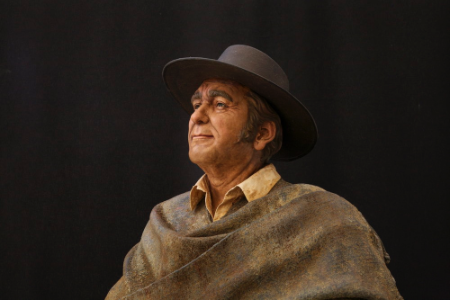
Manuel de Ocio. Photo courtesy of Museo Ruta de Plata
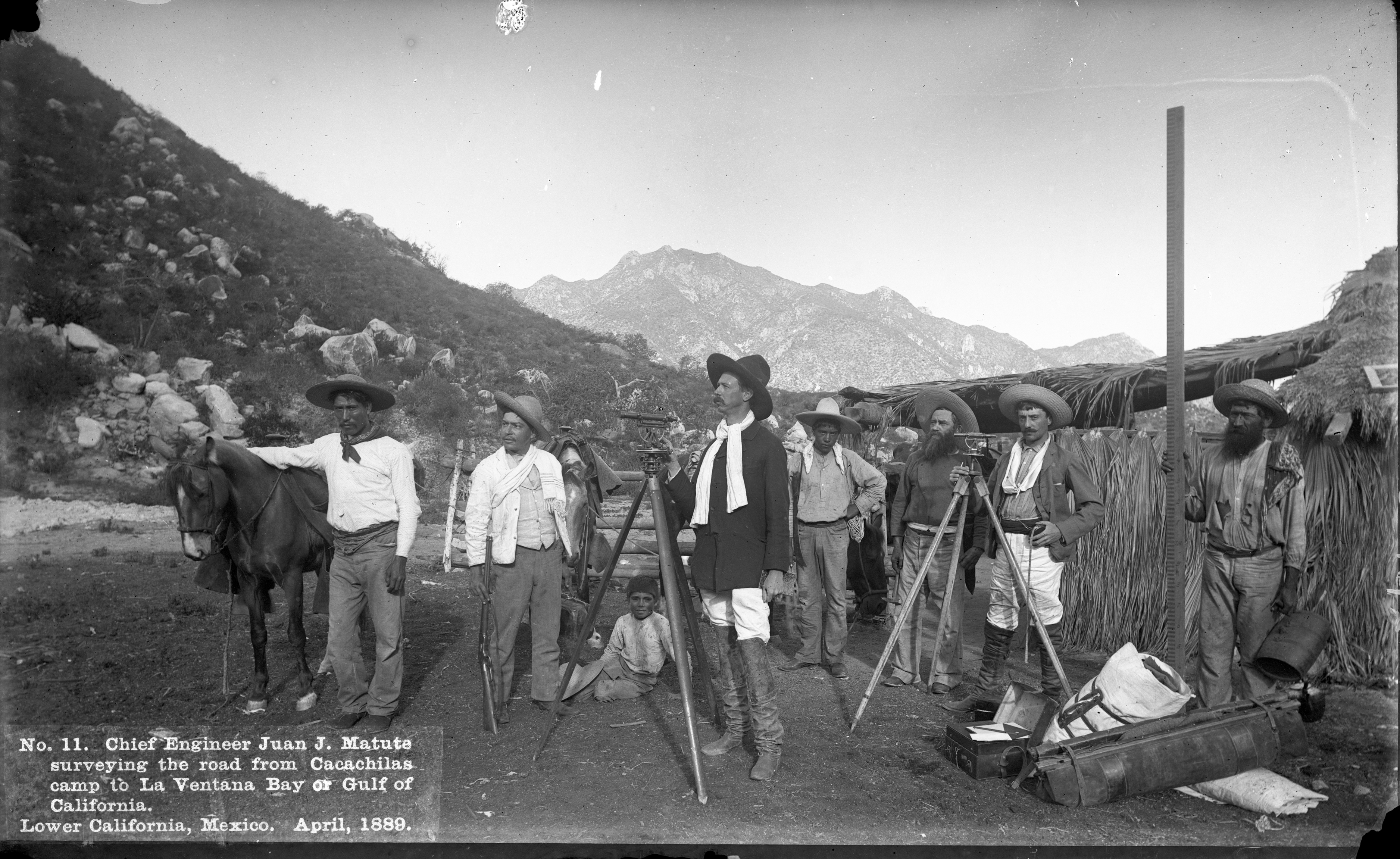
And so it happened that an act of God brought riches to the Jesuits’ earthly defenders and thereby created the first direct threat to their Baja California theocracy. The soldier who wrangled the majority of the profits from the great pearl bonanza was Manuel de Ocio, the Spanish son-in-law of the captain, who capitalized on his connections to broker the pearls and make the beginning of his fortune. In short order he resigned as a soldier, invested in pearling equipment and bought goods to trade with the Indians who were still collecting the pearls. Baja California’s first entrepreneur was launched, and he soon found he was not the only one eager to break the Jesuit monopoly. In 1743 the pearl-rich de Ocio went to Guadalajara where he found businessmen keen to push for a civil colony in Jesuit territory, and by 1748 he had laid claim to Santa Ana, site of an abandoned Jesuit chapel where a Spanish soldier had spotted silver ore in 1722. de Ocio created his home and cattle ranch there, and began mining silver near present day San Antonio. Real Santa Ana was the first secular settlement in Baja California, and San Antonio today is considered the oldest continuously settled town in the peninsula. The Jesuits were expelled from Baja California in 1767, but a thriving secular economy launched by de Ocio and built around mining continued for another 150 years.
Stories like de Ocio’s are the highlight and backbone of the Museo Ruta de Plata, the Silver Route Museum, which opened in the Baja Sur town of El Triunfo November 17, 2018. The brainchild of Christy Walton, Richard Kiy, John Reynolds, and Juan Jose Cabuto, the museum reflects the remarkable research the team conducted to resurrect and celebrate the mining heritage and societal changes wrought by de Ocio and others who came to the area to pursue their dreams. Troves of documents were recovered in the public archives of La Paz, descendants of key players in the town’s mining industry were tracked down and interviewed, and oral histories were gathered from families in the area who are direct descendants of the Mexican, French, German, Polish, Chinese, American, and English miners, entrepreneurs, teachers, tradesmen, artists, shop owners and others who created what was once the largest town in the Baja peninsula with one of its most diverse and fascinating communities.
Museo de Ruta Plata is part of a much larger project by Christy Walton, heir to a portion of the Walmart fortune, to create in the greater La Paz region of Baja Sur “a thriving economy and engaged social system that respects and nurtures our unique environment.” Her Baja-based Alumbra companies include: Rancho Cacachilas, a land management organization that engages in livestock management, gardening, honey and cheese production and ecotourism activities; Earth Ocean Farms, an offshore marine fish farming company; Sol Azul which engages in year-round oyster production, and Tenaja Holdings, a real estate development company that manages the silver museum. The integration of all these projects is readily found in the silver museum complex which includes Restaurant-Bar El Minero, a wonderful culinary destination built on the ruins of an old cantina, where on any given day you can enjoy traditionally-made cheese from Rancho Cacachilas, organic oysters from Sol Azul, and farm-bred totoaba (critically endangered in the wild) from Earth Ocean Farms. The museum itself was built on the site of some abandoned buildings that they believe once housed a tannery, all right next to the ruins of the silver mining and milling operations. In fact, it was when Walton saw some children playing in these ruins that she was inspired to create the museum as a way to help revitalize El Triunfo by promoting its cultural heritage, one that was perhaps already lost to its younger generations.
El Triunfo in its heyday. Photo courtesy of Museo Ruta de Plata
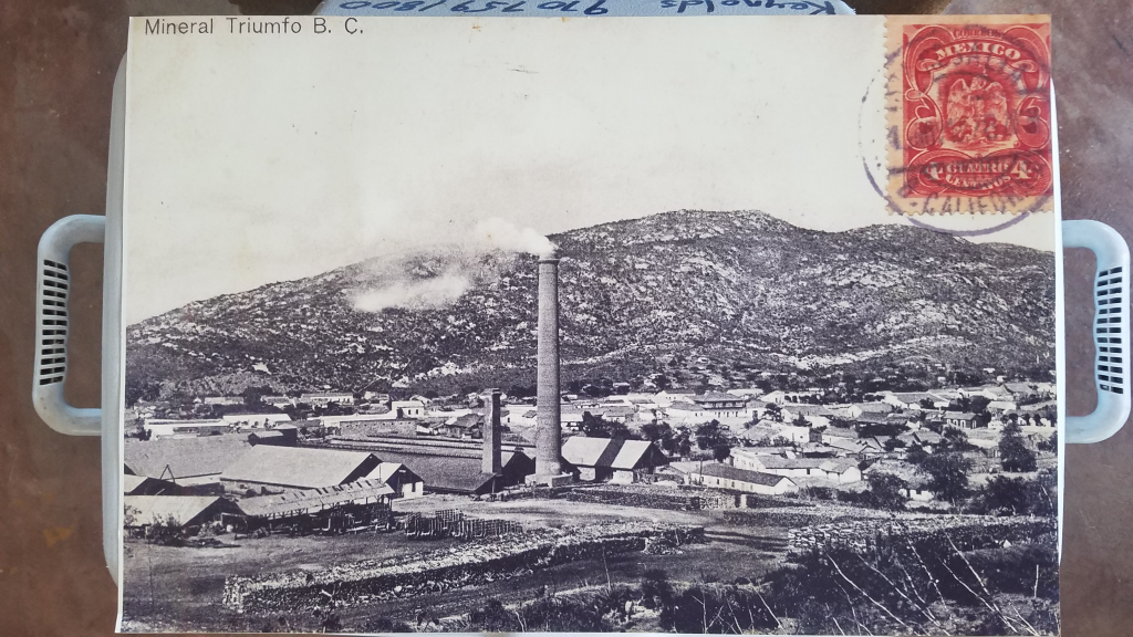
de Ocio started a major mining boom in the area and from 1862 to 1926 the network of gold and silver mining operations completely transformed the area, making El Triunfo and San Antonio the wealthiest towns in Baja California in the process. El Triunfo had been a sleepy little village of 175 souls in 1857, but by 1890 had grown to a vibrant hub of over 4,000 as people flocked to the area to make their fortunes. Money flowed and the residents invested in the good life; a huge number of pianos were imported from Europe, and classical music concerts and artistic performances were a regular feature of town life. Gourmands imported apples from San Francisco and the cantinas imported American beer from St. Louis and Milwaukee. It was even rumored that Gustav Eiffel, he of the Paris tower, designed the still-standing La Ramona smokestack in 1890 for the Progreso Mining Company. While the museum states there is no evidence that Eiffel designed the tower, for Eiffel fans it should be noted that there is no evidence that he didn’t either.
Photo Courtesy of Museo Ruta de Plata
1890 was an important year for El Triunfo on another front as well. The United States enacted a federal law called the Sherman Silver Purchase Act, which effectively made the US government the second-largest buyer of silver in the world, second only to the British Crown in India. Under the terms of the act the government was required to purchase an additional 4.5 million ounces of silver bullion every month, in addition to the US$2 to $4 million required previously. Silver mining around El Triunfo surged. But the Sherman Silver Purchase Act, initially conceived of as a way to boost the economy and create sufficient inflation to allow farmers and miners to pay off debts that had become untenable due to deflation, was unsustainable. It contributed to a major economic depression in the US, and in 1893 was repealed. The US moved to the gold standard and the price of silver plummeted.
It was the beginning of the end for the mining towns of BCS. The mines struggled and the Mexican Revolution of 1910-1917 exacerbated their challenges. Ultimately, the silver boom ended as it began, with a monumental storm. This time however, instead of riches being tossed upon the shore, the hurricane of 1918 washed them away, destroying much of the town and rushing arsenic from shattered mines downstream, devastating local livestock along the way. 25 human deaths were recorded, and all ships in La Paz were reportedly damaged, sunk or run aground. The last mine in El Triunfo closed in 1926, and the town shrank back down to the sleepy little town of a few hundred folks that it is today.
Today Mexico is the largest producer of silver in the world, producing 5,600 metric tons in 2017. But no one in El Triunfo seems to be clamoring for a return to the old mining days. Turns out the quality of the silver in the area wasn’t that great anyway. A 1906 US Consular report on display in the museum notes that the ore of the area “is not high grade and is very rebellious.” But the high price of gold in the global market today has created persistent efforts from companies outside of BCS to establish open pit gold mining in the area once again. For its part, Museo Ruta de Plata makes it clear that although mining for minerals drove the settlement of the area, mining for knowledge is the long-term economic path forward for the region. Exhibits in the silver museum laud the extraordinary biodiversity and natural beauty of the area, alongside the scientific research and distinct ecotourism opportunities they represent. As with places like the Galapagos that have a similarly unique and biologically diverse environment, jobs based in sustainable tourism, conservation and research seem to be the hope for the resurgence of El Triunfo and the surrounding towns of BCS. Even the Jesuits would have been happy about that economic plan.
Sources for this article include: Harry W. Crosby, Antigua California: Mission and Colony on the Peninsular Frontier, 1697-1768; Juan Jose Cabuto of Museo Ruta de Plata; and the displays and websites of Museo Ruta de Plata. www.museorutadeplata.com.
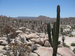
These days when you visit the Baja peninsula and the Gulf of California things can seem slow, lazy, sometimes as if not even time is moving. It is the moment, it is Zen, it is calm. This is not how things started. Baja and the Gulf of California were born from crashing tectonic plates, erupting volcanoes and the violence of geology. They were created quickly, in the blink of an eye, and not very long ago. Geologically speaking.
Dr. Scott Bennett of the US Geological Survey has studied the geology and tectonics of Baja California for years and published numerous scientific research articles on the formation of the peninsula and the Gulf of California. He lays out the process of their short, intense creation, and where you can identify pieces of the birth story on your travels throughout Baja. “100 to 80 million years ago (Cretaceous period), a subduction zone existed along the western edge of North America, including Mexico. The Farallon and North American plates were moving towards each other, with the Farallon plate subducting underneath the North American plate, heading down to the east. This subduction motion (writer’s note: some might modify “motion” with adjectives like smashing, hurdling, crashing) formed ancient volcanoes at Earth’s surface, and large batholiths of granite in the magma chambers below. Then 50 to 40 million years ago, the angle of the down-going Farallon plate seemingly shallowed, causing mountains, such as the Rockies in the USA and the Sierra Madre Oriental in Mexico, to shoot up throughout Western North America. This uplift, and the related erosion (which erased the previously formed volcanoes) brought the older granite rocks to the surface. These are the rocks that you see today stretching for miles as you travel through the Valley of the Cirios (Valle de los Cirios) in the mid-section of the peninsula, on Highway 2 between Tijuana and Mexicali, and in the Sierra La Laguna mountains between Todos Santos and San Jose del Cabo.”
Now it may seem to our human mindset that this all took place an exceedingly long time ago. But to understand just how young the Baja peninsula really is, consider that those who know how to calculate such things say that Earth is 4.54 billion years old, give or take 50 million years. That is to say, most of the action that formed the land of the Baja peninsula took place in the period of time that correlates to a margin of error for the formation of Earth. And we’ve only gotten to the granite and the mountains. What is now the Baja peninsula was still firmly attached to mainland Mexico, and the Gulf of California was not even a twinkle in the Pacific Ocean’s eye.
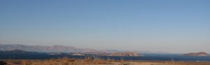
“Then 25 to 12 million years ago (Miocene period), the Farallon Plate in the Pacific Ocean started subducting east at a much steeper angle again, like a curtain whipping downwards” says Scott. “This steepening angle created more volcanoes, but their location shifted back to the west, tracking with the ever-steepening, subducting Farallon plate. The volcanic rocks from this period make up a lot of the flat top mesas that you see in Baja California today in areas like Cataviña and La Purisima, as well as the massive piles of volcanic rock in the high peaks of Sierra Madre Occidental in Sonora, Sinaloa and Nayarit. The Tres Virgenes Volcanoes, in the midsection of the Baja peninsula, were formed at the end of this period. Isla Espiritu Santo, off the coast of La Paz in the Gulf of California, gets its striking beauty from the wonderfully layered volcanic rock, mostly tuff (rocks made of compressed volcanic ash), that has been gently tilted along normal faults. Brian Hausback, a geology professor at California State University, Sacramento, has dated some of the volcanic rocks of Isla Espiritu Santo to 16-21 million years old, making them older than the formation of the Gulf of California seaway.”
Which means that, at this point in our story, the Baja peninsula is still stubbornly connected to the mainland. But we’re getting to the good part now!
“Then, 12 million years ago, the conveyor belt of subduction stopped” say Scott. Plates stopped colliding and the volcanoes slowly waned. There was calm. But then, thanks to a complex reorganization of tectonic plate motions, a new phenomenon emerged: oblique rifting. The plates began pulling apart, but at an oblique angle. Scott continues. “This oblique rift is called the Gulf of California Shear Zone. It became connected with the southern end of the San Andreas fault near the Salton Sea, which now made its way to Mexico. This resulted in right lateral fault motion in northwestern Mexico, and everything to the west of it began ripping away from the mainland, moving to the northwest, including the sliver of California that is to the west of the San Andreas fault – San Diego, Los Angeles, Big Sur, Santa Cruz. The area that is now San Jose del Cabo wrenched away from the area that is now Puerta Vallarta, and the formation of the Baja peninsula was in motion.” At last!
The rest of it didn’t take long. By 8 million years ago the rate of ripping (oblique rifting) increased and the Gulf of California seaway (finally!) started to form, with the waters of the Pacific Ocean trickling up to somewhere around La Paz. By 7 million years ago the Gulf of California seaway had trickled up to Guayamas, and by 6.3 million years ago the gulf waters had gone all the way up to the Salton Sea region, forming an extremely long and skinny Gulf of California seaway from Cabo to southern California that was probably no more than 10 to 50 kilometers wide and well over 1,000 kilometers long.
Of course, no current map shows the Gulf of California connected to the Salton Sea, and for that we can thank the Colorado River. About 5.5 million years ago it started flowing into the low-lying areas at the northern end of the Gulf of California (which was rapidly rifting apart) and forming large tectonic valleys that are similar to Death Valley today. The Colorado brought with it an enormous amount of sand and silt that essentially filled up the tectonic valleys across the entire area from the Salton Sea to the current Gulf of California, forming an agricultural river delta between Mexicali and Yuma. When you look at Google Map imagery of the Gulf of California today, you can clearly see the smooth, sandy bottom that characterizes the seafloor in the northern part of the gulf where the Colorado River deposited sand and silt, in contrast to the jagged and faulted continental remnants that characterize the seafloor in the central and southern Gulf, from about Bahia Los Angeles on down. The whole story is written right there on the seabed.
And the story is not over yet. The Gulf of California is still rifting apart, and the Baja peninsula continues its journey to the northwest, moving away from mainland Mexico at about 45 millimeters per year, although sometimes much faster. Observes Scott, “We are constantly reminded of the active tectonic plates in the Gulf of California by large earthquakes of Magnitudes 4 to 6 that occur in the Gulf every year. The most recent large earthquake (M7.2) occurred in northeastern Baja California on Easter Sunday 2010, tearing a 120-kilometer gash across Earth’s surface, and moving the Baja peninsula several feet towards the northwest in less than a minute.”
Baja’s journey will continue. Along with the southern parts of the US state of California that are to the west of the San Andreas fault, Baja will continue to travel roughly 50 kilometers every million years, eventually sliding past Vancouver and Juneau and colliding with Anchorage in 50 million years or so. Which, remember, is just the margin of error for the age of Earth. We are practically there.
There’s a sucker born every minute. That’s right. There’s a high possibility that you are personally a sucker, an even greater probability that most of your extended family members are suckers, and it is almost certain that your circle of friends and acquaintances suck too. How could we know such a thing? Simple mathematics. The United States is home to roughly 325 million people, yet the country uses 500 million plastic straws per day. That is to say, each person is using an average of 1.5 plastic straws per day. And that’s just one country. As a species, we suck on a global scale.
Of course, the thing that really sucks is that a huge percentage of these plastic straws are ending up in our oceans. The Earth Institute of Columbia University estimates that the Great Pacific Garbage Patch is twice the size of the continental United States. Of all that garbage, an Ocean Conservancy study concludes that fully 60% of it consists of items that society terms “disposable”, plastic bags, food containers, plastic bottles and plastic straws. The Ocean Conservancy estimates that a plastic straw, used for 15 to 30 minutes to consume one drink, can take up to 100 years to decompose. A plastic bag that you use for 15 minutes to transport your purchase from store to home can take 150 years to decompose. Plastic bottles can take up to 450 years.
So, that sucks, but why should us suckers care? Turns out plastic, it’s what’s for dinner. A recent study by the Ryan Institute concludes that 70% of fish in the North Atlantic have ingested plastic. Another study by Ghent University in Belgium estimates that shellfish lovers are eating upwards of 11,000 plastic fragments in their seafood each year. That plastic straw that seemed so harmless in your drink at lunch could actually come back to haunt you in your seafood dinner. And that’s the thing: plastic is personal. Which is why towns across Baja California Sur, including Todos Santos, Pescadero, La Paz, Cabo Pulmo and Los Barriles are taking a stand against plastic straws and other single-use plastics. Baja is a strip of land bounded by two oceans, so what we do in our towns has an immediate impact on our oceans.
Baja is the place where 5 of the world’s 7 turtle species come to nest (sea turtles mistake plastic bags for their favorite food, jelly fish, and die from ingesting the plastic; plastic straws also get stuck in their nostrils and air passageways), it is home to 39% of the world’s total number of marine mammal species (sea lions and others are getting entangled in plastic bags and packing bands, and dying from infection or strangulation), it is where one third of the world’s whale and dolphin species spend their time (a dead sperm whale was recently found with 29 kilos of plastic in its stomach), it is a critical part of the Pacific flyway and home to over 430 bird species (National Geographic states that 90% of sea birds are ingesting tiny bits of plastic that they lethally mistake for food), and the Sea of Cortez alone is the home of 891 fish species that supply over half of Mexico’s fisheries, from whence we get our seafood dinners. So ridding the area of single-use plastics is a deeply personal matter for residents of Baja. Says Mayra Victoria Gutierrez Sandoval, leader of the Déplastificate movement in Baja Sur, “Every time you personally consume a piece of plastic, you have to be personally responsible for what happens to it. That is the only way to eradicate the problem.”
Teresa Egea, Gardens, Sustainability & Spa Director at the hotel Rancho Pescadero and its Garden Restaurant, firmly believes in taking personal responsibility for reducing the use of plastics. “My philosophy is to practice the R’s, which are not only reduce, reuse, and recycle, but also reinvent and redistribute. I came to Rancho Pescadero 6 months ago and wanted to reinvent the use of the popote. Our mixologist is from Oaxaca, where he developed a project of plant-based straws created by local communities with local plants, specifically Arundo donax, a type of cane. These straws are very beautiful, washable and reusable and our guests love them, not only because they are enjoyable to use, but because they represent a sustainable alternative to plastic, and redistribute income away from plastic producers to local communities. Moreover, since we switched from plastic straws to the cane straws, our straw costs have declined by 2.5 times – it is a very profitable option and therefore a sustainable option for the business as well.”
Marimar Higgins, owner of La Esquina restaurant in Todos Santos, has long been a proponent of no popotes and eliminating single-use plastics. “We are serving straws less and less, and the ones we do serve are made out of paper. Almost all of our to-go containers are biodegradable, and we charge 5 pesos for all to-go items to make people think twice before taking away.” Michael and Pat Cope of Michael’s at the Gallery gave up popotes and plastic water bottles long ago as well. Reflecting on such trends, Jürg Wiesendanger, owner of Hotel Posada La Poza says of the Déplastificate movement in Baja, “It is like banging on an open door.” And that is the exciting thing. While the movement to rid Baja of single-use plastics is gaining new momentum, restaurants like Posada La Poza’s El Gusto! gave up plastic straws a while ago, and are currently evaluating how best to continue their forward momentum. Plenty of local companies are charging ahead. Alma and Manny’s, a much-loved local restaurant, stopped giving patrons plastic straws a year ago. New fish taco restaurant Santo Chilote not only doesn’t offer popotes to its patrons, it offers a discount to diners who bring their own takeaway containers. Landi Ortega eliminated popotes at her restaurant, Landi’s, over a year ago, Chef Sergio Rivera eliminated them from his restaurant La Casita a month ago, the Hotel Guaycura and its restaurants are celebrating their first popote-free season, and El Refugio owner Rachel Glueck has never had a popote on her premises. Feliz Ramon Vazquez Guluarte recently implemented a new program at his coffee shop, Cafélix, and now uses only compostable straws and glasses and environmentally-friendly take-out containers. Joella Parsons, owner of Pura Vida, is doing the same. Other businesses like La Morena, Fonda El Zaguán, La Santeña, Que Rico, Gallo Azul, Caffe Todos Santos, Café Santa Fe, Los Adobes and Cerritos Surf Town are actively working on their strategies for eliminating single-use plastics.
The Todos Santos Restaurant Association is totally committed to the movement. “To protect our oceans, sea turtles and other marine life, each restaurant that belongs to our association is committed to eliminating the use of plastic straws as a first step to becoming “green” restaurants. Our goal is to replace all single-use plastics with products made of compostable materials. The restaurant industry is united with the other sectors to make Todos Santos a town without single use plastics.”
That, most emphatically, does not suck! So next time you’re in a restaurant in Baja California Sur, don’t be a sucker. Ask for your drink “Sin popote por favor”. The turtles thank you!
RESOURCES FOR LOCAL BUSINESSES AND COMMUNITY MEMBERS:
• For more information on the Déplastificaté movement in BCS please visit their Facebook page at: https://www.facebook.com/DesplastificateMX/
• If you’re a local business looking for suppliers of non-plastic solutions to your business needs, and/or artwork and other informational tools for your employees and clients, please email Mayra Gutierrez at or Bryan Jáuregui at
• For recycling solutions in Todos Santos and Pescadero, please contact Alex Miró at: https://www.ecorrrevolucion.org
The National Geographic Society, as venerable an institution as ever graced the shores of the North American continent, has an image problem. Since 1888 the NGS has been supporting adventurers and explorers of every stripe across all the corners of the globe, and such is their success that it is now safe to say that we know it all. Satellites and surveyors, exploring on the ground and from the air, have neatly filled in all the spaces on the old maps where there used to exist nothing but the terrifying admonition: Here be dragons! Does this mean that the Age of Exploration is dead? Is there no more geography left around which a society can coalesce for discovery? Is the NGS, as some naysayers opine, obsolete?
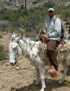
Dr. Jon Rebman in the Sierras
Not a chance. A glance at the interactive NGS global explorers map, which shows thousands of explorers engaged in equally numerous projects across our well-mapped continents, definitively lays that notion to rest. A zoom from the global view of the map down to our own Baja California Sur shows just how vibrant an era of discovery we inhabit. Here you’ll find a hiker symbol in the Sierra La Laguna mountains just outside of Todos Santos, which is the avatar for NGS explorer Dr. Jon P. Rebman, director of the San Diego Natural History Museum’s Botany Department, and author of the definitive Baja California Plant Field Guide. Dr. Rebman’s work demonstrates not only that the Age of Exploration is alive and well, but that we are always gaining a deeper knowledge of the areas depicted on our maps. Perhaps more importantly, we are conserving the existing knowledge of these areas that is in danger of slipping away.
Explains Dr. Rebman. “After 20 years of floristic research on the Baja California peninsula and adjacent islands, my colleagues and I created an annotated, voucher-based checklist of the vascular plants of Baja California. We published this in 2016, and when we compared it to the only floristic manual for the entire Baja California region published by Wiggins in 1980, we found that we had added more than 1,480 plant taxa to the area, including approximately 4,400 plants (3,900 vouchered taxa plus 540 reports), of which 26% are endemic to the region. As part of this process we identified several plants in Baja California that are very rare and only known from one to very few collections.”
“We got focused on the need for conservation efforts to protect the region’s rare flora during a November 2013 expedition in the Cabo Pulmo area to document biodiversity in an area slated for development. My colleagues and I documented two plant species that had been lost, meaning not collected or scientifically documented, for decades. One of these rediscoveries was Stenotis peninsularis (Rubiaceae), a micro-endemic species that was last collected in 1902 by T.S. Brandegee. Yes, that means we had not seen this species in over 110 years!”
Inspired, Rebman continued his quest for the lost plants of Baja during a workplace re-assignment from San Diego to La Paz August 2015 to June 2016. Working with local Baja botanists, he rediscovered approximately 50 plant species in the Cape region that were known from just one, or a tiny number, of historical specimens. But there were more. Specifically, there were 15 more “lost” plants, all endemic to the Baja California peninsula, that had been collected between 1841 and 1985, but had not been seen since. Rebman was intent on finding them. “With the ever-increasing detrimental impacts to native plants and natural landscapes, I realized that the time was now to attempt to re-discover some of Baja California’s very rare, unique, and presently “lost” plants before they are gone forever.” The National Geographic Society agreed to fund the project, and Rebman got his Mexican colleagues – Dr. Jose Luis Leon de la Luz, Dr. Alfonso Medel Narvaez, Dr. Reymundo Dominguez Cadena and Dr. Jose Delgadillo – to join the effort. But how do you find a “lost” plant? It’s not for the faint of heart – spiritually, physically, or intellectually-speaking.
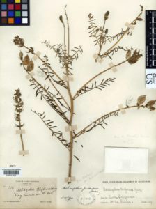
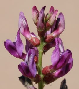
Astragalus piscinus: an image of the holotype specimen deposited in the united States national Herbarium (uS) at the Smithsonian.
Consider. In March 1889, self-taught British botanist Edward Palmer disembarked from a boat at a place on the Baja peninsula that he called “Lagoon Head”, found what he thought was a common weedy plant, and deposited it in an herbarium without further ado. Sometime later, renowned American botanist Marcus E. Jones found it in the herbarium, realized it was a very rare, endemic Baja California plant species, named it Astragalus piscinus, (common name Lagoon Milkvetch), and that was the last time anyone recorded it. In 1884 noted California naturalist Charles Orcutt was in a place he christened “Topo Canyon” when he chanced upon the very rare Physaria palmeri, took a sample, and recorded it with the fledgling San Diego Natural History Museum. No one has noted a sighting of it since. The entire list of the 15 lost plants Rebman and his colleagues set out to find reads like this, with very precise information about the plant, but incredibly imprecise information about the location. Therefore, the first thing the team had to do was pore over the papers, books and letters of the botanists who originally discovered the plants, and do their best to figure out where, exactly, in this 1,000 mile long peninsula, these botanists were when they took their samples. As a result, one of the cool byproducts of the expedition is a map put together by the NGS team that shows the place names used by these early botanists with the actual place names in use today. As every good cartographer knows, maps are an ever-evolving business.
The team narrowed down the possible locations for each plant (“Lagoon Head” turns out to be near Scammons Lagoon and “Topo Canyon” in the mountains of northern Baja), but then they had to actually find these very rare plants in an area that they had already demonstrated held over 4,400 different plants. It would seem almost impossible to make any progress while stopping to investigate all the different possibilities. Unless, of course, you are already so familiar with all the plants that you can immediately discern the one you don’t know, the one you’ve only seen as a specimen or a drawing. John Rebman and his Mexican botanical collaborators are quite possibly the only people alive today to stand a chance of finding any single one of these 15 lost plants. Yet so far, they have looked for ten and found seven. For the others, they need to wait for rain, in Baja, to find the blooms.
“It has not been easy” remarks Rebman. “We were in a desolate area in northern Baja where bandits are known to congregate, and I was looking for Orcutt’s
Astragalus piscinus flowers. Photo by Jon Rebman
Physaria palmeri. There were signs that the bandits were around, and alarm bells were going off in my head. But I had read Orcutt’s journals, had a firm sense of where he had been the day before he discovered the plant as well as the day after, and I really believed I was close. Yet I kept not finding the plant and kept getting more nervous. Finally, I decided that if I hadn’t found it by the time I reached the next tree, I would turn around. I got to the tree, got off my horse, looked down, and there it was. Orcutt, probably found it when he stopped to take a break in a shady spot all those years ago.”
Finding each of the 7 plants they’ve recovered so far has required serious expeditionary skills and effort, with horses, burros, camping gear, local guides, packed water and food. It’s been hot, it’s been dusty and, as we have seen, sometimes it’s been scary. But, as happens with most NGS projects, the results have been quite tidy. Says Rebman, “For each “lost” species that we encountered, we scientifically documented each population using standard protocols to make an herbarium specimen, we recorded all necessary label data, took a census of the populations, and assessed any visible threats to the well-being of the plant populations. Primary herbarium specimens have been deposited in the SD Herbarium at the San Diego Natural History Museum, and duplicate specimens have been deposited in the HCIB Herbarium in La Paz, Baja California Sur, and the BCMEX Herbarium in Ensenada, Baja California. I photographed each re-discovered plant using a digital camera, and these images, along with the map depicting old and new place names together, can be found at bajaflora.org.”
Dr. Alfonso Medel Narváez with Bouchea flabelliformis (Verbenaceae). Photo by Jon Rebman
While looking for the “lost” plants of Baja, Rebman and his team actually made several new discoveries. “From the expeditions we have taken so far, we have already encountered 30 new species previously unknown to science, all sitting in my cabinet awaiting further investigation.”
The NGS likes to quote American explorer Vilhjalmur Stefansson, who said you never should have an adventure if your planning is good and you pull off every detail; an adventure is when things go wrong. With multiple expeditions looking for 15 ultra-rare – or possibly even extinct – plant species in poorly-described locations, there is bound to be an abundance of adventure in the process for Rebman and his botanical collaborators. But that is the essence of discovery, the essence of exploration, and Rebman and his team are showing us that there is still a huge amount to be discovered, and re-discovered about the places where the dragons used to roam.
Lawyers, guns and money. For the last several hundred years these have been the tools employed throughout the Americas to resolve land use and land ownership issues, and the system continues to thrive in present-day Baja California Sur. If you have enough of all three deployed in the correct proportions, you can generally carry the day. So how could the staff of a resource-restricted, government-operated, conservation-driven institution face down a large multinational company aiming to put an open pit gold mining operation in the UNESCO-certified natural area that they are charged with protecting? If you’re the employees of CONANP (The National Commission of Natural Protected Areas) in Baja California Sur you look to the earth. You invoke the powerful forces of nature. You call in the botanists.
When the CONANP team first met Dr. Sula Vanderplank of the Botanical
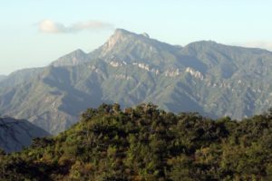
Sierra El Taste.Photo by Jon Rebman
Research Institute of Texas in 2014, she and her colleague Dr. Benjamin Wilder of the University of Arizona and Next Generation Sonoran Desert Researchers (N-Gen; www.nextgensd.com) had just completed a terrestrial biodiversity study of the lands surrounding Cabo Pulmo National Marine Park. Not coincidentally, these were the same lands targeted by a developer with plans to construct a massive 30,000-room hotel complex on the shores of the marine park. While there are likely many factors that ultimately lead to the termination of the project –massive protests, focused effort by leading local and international NGOs, international media scrutiny – it is beyond a shadow of a doubt that the findings of the team lead by Sula and Ben were a strong contributing factor. Why? In the area where they were to construct the hotel the botanists and their bi-national, multi-disciplinary team recorded no fewer than 560 species of flora and fauna. Of those, 100 (almost 1 in 5) are endemic to the Cape region of Baja California Sur, and 42 are on the Mexican endangered species list. Until that time, no one had any idea of the magnitude of the biodiversity of the area. As the authors of the study concluded, “Given the large number of endemic species present in the area, large-scale development projects risk the full scale and local extinctions of endemic species with narrow geographic ranges. Entire species could be lost forever (and their roles within the Sonoran Desert ecosystem) from the unique places where they evolved in situ during thousands or millions of years.”
Development ‘s deadly impact on biodiversity: CONANP was inspired. Gold mines operating in a protected natural area: N-Gen was invigorated. The opportunity to bring serious scientific scrutiny to Arroyo La Junta and the Los Cardones open pit gold mining project: it was too compelling to ignore. The CONANP/N-Gen team of Sierra scientific superheroes was born.
Now fictional superheroes like Bruce Wayne and Tony Stark conveniently come with immense family fortunes to back their earth-saving endeavors. Not so with reality-bound botanists and their colleagues. When Sula and Ben were first introduced to the Arroyo La Junta area in the Sierra foothills where the Mexican government had authorized the Los Cardones mining project, they couldn’t find much science on the area. A good bit of work had been done at the higher elevations of the Sierras, but the area around the proposed gold mine had remained a generally science-free zone. With the help of CONANP, Sula and Ben set out to change that and, as they had done in Cabo Pulmo, created a proposal to bring rigorous scientific investigation and analysis to determine the magnitude of endemism and biodiversity in the area. CONANP was thrilled. Potential funders were silent.
Anti-mine protest in Todos Santos town plaza. Photo by Kamal Schramm
“Then an interesting thing happened” says Ben. “When the government approved the MIA (environmental impact assessment) of the Los Cardones mine, the people of Todos Santos and La Paz rose up in protest and staged rallies and marches against the mine. This public outcry really gave new life to the importance of understanding the potential impact to the biosphere reserve.”
Anne McEnany, president of the International Community Foundation, had been involved in educating people about economic activities in the Biosphere Reserve for years, and immediately grasped the importance of the N-Gen project. “ICF has been working with local organizations to educate and inform the general public about the Biosphere Reserve and the La Paz watershed by developing curriculum, analyzing potential economic activities, and convening workshops. When the N-Gen research team approached ICF to finance a biodiversity assessment there, we knew it was the right next step. How can CONANP appropriately manage such a large area without knowing what is there?” The CONANP team breathed a sigh of relief. The botanists got busy.
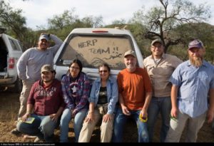
Sula came down in September 2015 to scout out the area and to work with the director of the Sierra La Laguna Biopshere Reserve, Jesús Quiñónez Gómez, on the permitting required for the team to conduct its research. The scouting trip a little scary. Recalls Sula, “The Los Cardones people had guards and check points at several spots in the Arroyo La Junta area, and it was definitely a little intimidating. So when we came back with the whole team in December 2015, we were apprehensive about the type of reception we might receive.” The “whole team” consisted of 46 participants, including 29 scientists from 19 institutions (10 from Mexico and 9 from the US). Everyone was a little nervous, but by the time the team arrived to conduct their 8 days of investigation starting on December 4, 2015, the roadblocks and guards had been removed and the team worked without interference.
And apparently without much sleep either! The group, many of whom had worked on the Cabo Pulmo study and are part of the N-Gen network of investigators, consisted of 5 main teams of scientists: 4 botanists (the plant people), 6 entomologists (the insect folks), 8 herpetologists (the snake and lizard researchers), 7 mammologists (self-evident) and 4 ornithologists (the birders). Specialists for each taxonomic group worked almost around the clock, systematically surveying different areas as daytime collections gave way
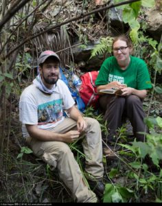
Herpetology Team. Photo by Alan Harper
to nocturnal studies, which in turn rolled into bird surveys underway well before dawn. A CONANP management team of 10 people kept the whole project going, while the Rancho Agua de Enmedio family kept them all well fed, and Niparajá assisted with local logistics.
It couldn’t have been more perfect: a CONANP-inspired, ICF-funded, N-Gen-executed project with a multinational team of scientific rock stars to assess the biodiversity of an area that has been consigned to the ravages of open pit gold mining. It is the people of Baja California Sur’s dream team, and if ever salvation were at hand, it is now. But “now” is December. The rains of summer are but a distant memory so few annual plants persist, and the perennials are not sporting many of their distinguishing flowers and fruits; the botanists are challenged. The weather is cool and the cold-blooded snakes are not inclined to come out; the herpetologists find solace in the amphibians. There’s water in the arroyo so land mammals are around, but volant mammals (AKA bats) are the least likely to be active in the Sierras in December; the mammologists scan the night skies with few catches. Aquatic invertebrate communities often show great seasonal variability, and there are substantial taxonomic limitations to larval identification; the entomologists take pleasure in the huge number of harvestman spiders around that freak out all the other scientists. Lots of birds are in residence, but several important species frequent the Cape Region only in summer; the ornithologists make do with what they have.
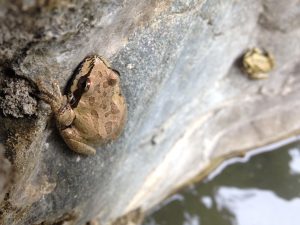
Baja California Sur Tree Frogs. Photo by Michael Bogan
All of which makes it even more impressive that in the 500 hectares (1,235 acres) of land currently petitioned for use as the Los Cardones open pit gold mine project, the N-Gen team found 877 (eight hundred and seventy-seven!) species of flora and fauna, including 107 species endemic to the Cape Region alone, and 29 species listed as endangered by the Mexican government. Not only that, entirely new species were documented, including 2 insect species (and possibly more), and a completely new plant species record for the entire Peninsula, Brickellia diffusa, part of the sunflower family. And given the limitations of their research – they only had 8 days at a relatively unproductive time of year – the results are all the more astounding. In fact, the scientists reckon that their study represents only 25% (invertebrates) to about 50% (reptiles and amphibians) of the total species present in the region. It’s the frickin’ Garden of Eden on a 500 hectare lot.
But everyone knows that the Garden of Eden comes with a fast-talking serpent (apologies herpetologists) who doesn’t have the happiness of mankind at heart when he offers temptation to the innocent. As Exequiel Ezcurra, Director of the California Institute for Mexico and the United States (UC MEXUS) and co-editor of the study writes in the introduction to the soon-to-be-published study, “At the end of ten years of operations, the Los Cardones mine would have extracted about 173 million tons of rock, 135 million of which will have been deposited as waste in large pilings, and 38 million tons will have been accumulated in tailings in the form of sediments saturated with cyanide solution. In those ten years the project would have consumed about 300 million kilowatt-hours from the local power grid, releasing about 150,000 tons of CO2 into the atmosphere generated by the consumption of about 100 million liters of fossil fuels. In return, the project would generate only about 200 jobs for the entire region and only a meager eight tons of gold for the benefit of a private company.”
Scarier still, like the Garden of Eden, Arroyo La Junta is bounded by rivers, and its tributaries lie along the division of two watersheds. The ridge just to the north of Arroyo La Junta demarcates the boundary where water flows to the La Paz watershed, ending in the Gulf of California. Arroyo La Junta itself flows towards Todos Santos and empties into the Pacific Ocean. As Exequiel writes, “The mining project Los Cardones….plans to extract gold at the headwaters of the La Paz watershed treating the extracted rock with tons of cyanide, an amount sufficient to kill the entire population of Mexico.” Everyone on the peninsula knows that just one big hurricane could release a disaster of untold proportions from the mining site – it’s already happened in Sonora.
Of course it is the water that is the very source of the incredible biodiversity of Arroyo La Junta. The aquatic organisms that the water supports attract a vast array of predators like bats, birds and spiders, and the huge number of insects attracts reptiles and amphibians like frogs, who in turn attract larger predators like raccoons and coyotes. The arroyo is not just a source of drinking water for many of these species, it forms the actual basis for regional biodiversity. The humid air and damp areas extend the active period for many species, most especially reptiles, which means that they can extend their ecosystem functions for a larger part of the year.
CONANP discussed the study’s results. “When a company arrives to undertake a project in a protected area, the government wants to know if the project is compatible with the
Dr. Benjamin Wilder and Dr. Sula Vanderplank at Arroyo la Junta. Photo by Alan Harper
mission of that area. In this case, the protected area is the Sierra La Laguna Biosphere Reserve, and the mission of CONANP is to protect its biodiversity for future generations. The results of this study reaffirm that mining is incompatible with that mission. The mining company says that it can restore everything as it was after it digs these huge holes in the earth, but this study proves that restoration would be extremely difficult, if not impossible.” Ben is more direct. “The biodiversity numbers of the mining company’s MIA (environmental impact assessment) don’t even come close to what we documented. Restoration to what we see today after 10 years of mining would be impossible.” Exequiel agrees. “…we want to remind ourselves again, extinction is forever; our children will never be able to see the species that our generation pushes to oblivion.”
Lawyers, guns and money. In some cases these tools bring clarity, but in others they are employed to obfuscate, intimidate and renumerate away obstacles. And therein lies the beauty of the N-Gen study – it is pure, crystal clear, science. Every fact fully documented and not subject to dispute. And the timing could not be better as there is now a precedent for scientific institutions setting environmental parameters for mining operations. On February 8, 2016 Colombia’s Constitutional Court repealed Article 51 of the National Development Plan that had allowed the Environmental Licensing Authority to authorize mining projects in the Andean paramos, tropical alpine ecosystems. It ordered the Ministry of the Environment to use the map created by a scientific research institute, the Alexander von Humboldt Institute, as the basis for demarcating the boundaries of the paramo habitat. As Exequiel writes, “This was the first time a country had so explicitly put the human right to a safe water supply above the interest of big mining companies. It was also the first time that a nation had given such importance to a scientific research institute in the decision making process.”
Arroyo La Junta is in the part of the Sierras that was designated a Biosphere Reserve by the Mexican government in 1994 and by UNESCO in 2003. So the area’s value has long been suspected, but now, because of the inspiration of the CONANP team to bring in the scientific star power that is the N-Gen network, the true natural wealth of the area has finally been documented and all the players know exactly what is at stake: “Hundreds of species, many of them rare and endemic, others new to science or yet to be described.” The incredibly high rate of endemism is a result of the extreme isolation that the Sierras enjoyed for possibly millions of years. It is the natural heritage of the Mexican nation, and the very source of life for the residents of the Baja California peninsula. All the gold, all the lawyers and all the guns in the world cannot replace it. The botanists showed us that.
Study Findings:
Group
No. Taxa
Endemics
NOM-059
Endangered Species List
Plants
381
77
2
Insects
366
15
0
Reptiles & Amphibians
24
6
16
Mammals
29
3
2
Birds
77
6
9
TOTAL
877
107
29
Participating Institutions:
Mexican Institutions
US Institutions
@Lab
Botanical Research Institute of Texas
CIBNOR
Next Generation Sonoran Desert Researchers
CICESE
Orma J. Smith Museum of Natural History, The College of Idaho
CICESE, Unidad La Paz
San Diego Natural History Museum
CONANP
San Diego State University
Fauna del Noroeste
San Diego Zoo Global
Niparja
Sky Island Alliance
Rancho Agua de En medio
University of Arizona
Terra Peninsular
University of California, Santa Cruz
University of Guadalajara
Vanderplank S, BT Wilder, E Ezcurra. 2016. Arroyo la Junta: Una joya de biodiversidad en la Reserva de la Biosfera Sierra La Laguna / A biodiversity jewel in the Sierra La Laguna Biosphere Reserve. Botanical Research Institute of Texas, Next Generation Sonoran Desert Researchers, and UC MEXUS. 159 pg.
The study will be published in June 2016, and you will be able to find it on the N-Gen web site at www.nextgensd.com.
Todos Santos Eco Adventures operates trekking and cultural programs in the Sierra La Laguna Biosphere Reserve, working with local ranchers and their families. For more information please visit www.TOSEA.net
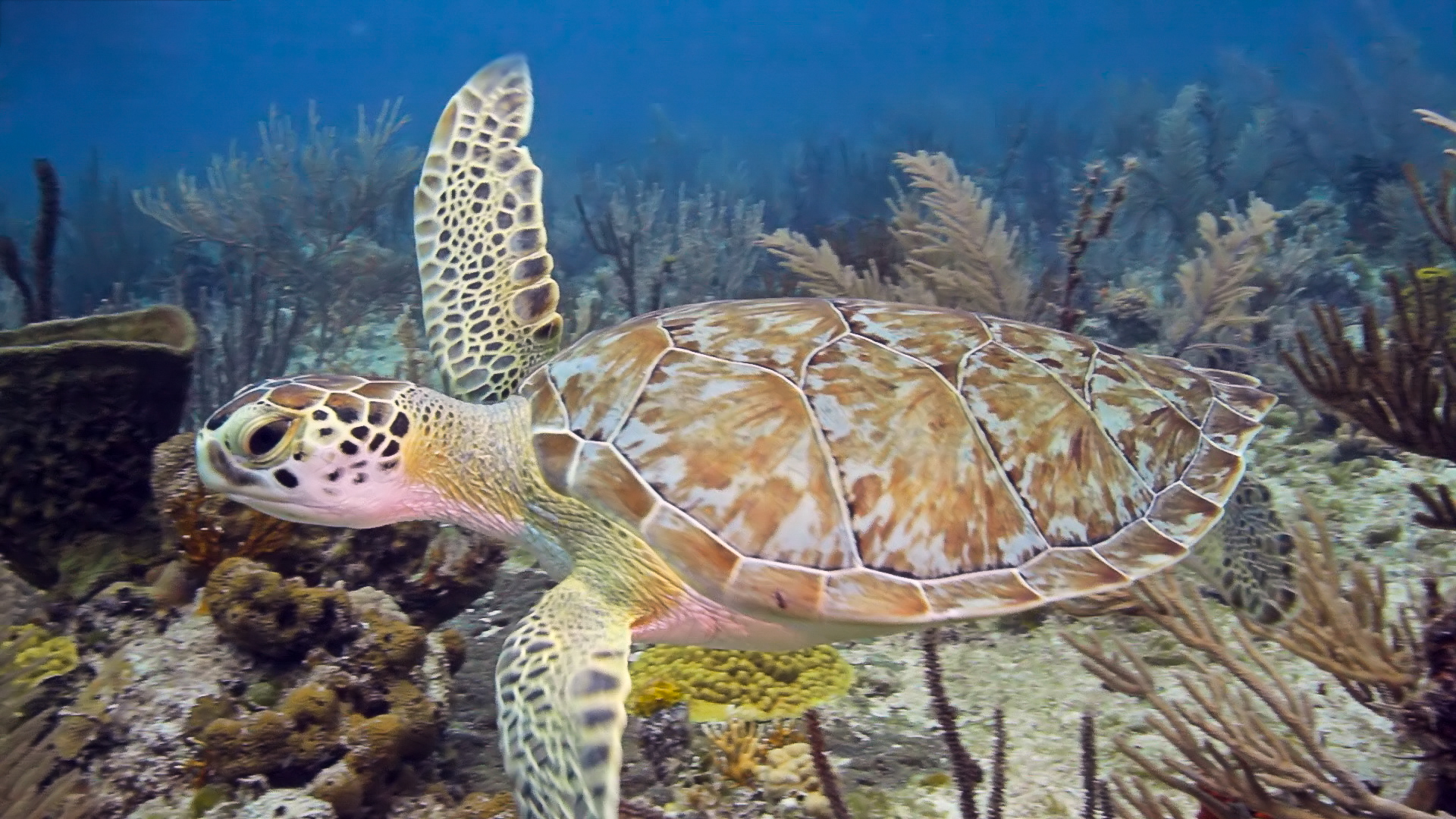
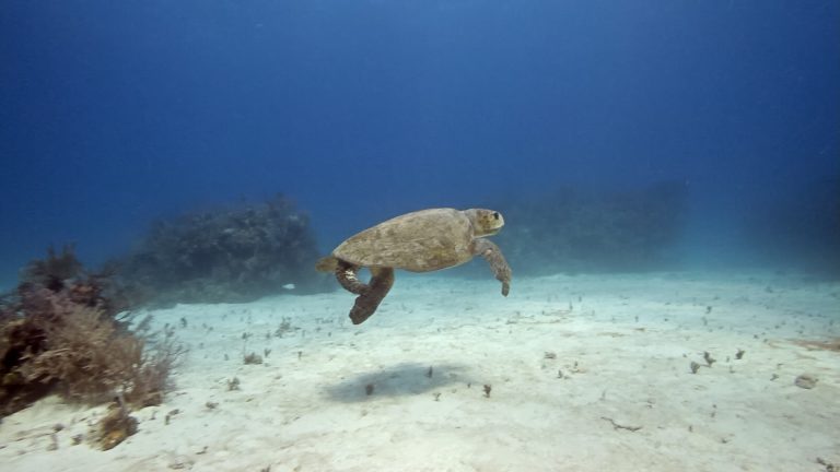
If they had a World Championship for Insult Hurling, China’s entry of “Son of a Turtle!” may not seem like obvious prize material. But a review of sea turtle reproductive habits reveals why the insult might be a contender: A female sea turtle will mate with several males prior to nesting season, storing the sperm of all her paramours in oviducts separate from her eggs for extended periods of time – sometimes years. When the time is right for nesting, her body will allow the sperm to fertilize the eggs, resulting in what scientists like to call “multiple paternity” for her offspring. In other words, little baby sea turtles have no idea who their daddies are. Get it?

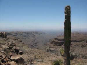 “Then 25 to 12 million years ago (Miocene period), the Farallon Plate in the Pacific Ocean started subducting east at a much steeper angle again, like a curtain whipping downwards” says Scott. “This steepening angle created more volcanoes, but their location shifted back to the west, tracking with the ever-steepening, subducting Farallon plate. The volcanic rocks from this period make up a lot of the flat top mesas that you see in Baja California today in areas like Cataviña and La Purisima, as well as the massive piles of volcanic rock in the high peaks of Sierra Madre Occidental in Sonora, Sinaloa and Nayarit. The Tres Virgenes Volcanoes, in the midsection of the Baja peninsula, were formed at the end of this period. Isla Espiritu Santo, off the coast of La Paz in the Gulf of California, gets its striking beauty from the wonderfully layered volcanic rock, mostly tuff (rocks made of compressed volcanic ash), that has been gently tilted along normal faults. Brian Hausback, a geology professor at California State University, Sacramento, has dated some of the volcanic rocks of Isla Espiritu Santo to 16-21 million years old, making them older
  than the formation of the Gulf of California seaway.”