by Sonya Bradley | Active Adventures, Adventure, Arts & Culture, Blog, Conservation, Culture, Education, Food, Geology, History, Our Properties, Places, Plants, Ranchero Culture, Relax, Sports, Whales, Wildlife, Wildlife Encounters
 As a traveler, you have the unique opportunity to enjoy unforgettable experiences while making a positive impact on the world. Sometimes the question is just, “how?”
That’s where Tourism Cares’ Meaningful Travel Map comes in!
We are thrilled to have partnered with Tourism Cares to be among the incredible organizations included on the map. This dynamic tool includes more than 350 vetted, sustainable travel organizations from around the globe — highlighting tours, activities, and businesses that offer a unique, authentic experience while prioritizing environmental stewardship, cultural preservation, and community benefit.
The following are just a few reasons to consider the map before making travel plans:
Enriching Travel Experiences: The Map provides a list of authentic, immersive experiences that go beyond traditional tourism offerings, which allows you to connect deeply with the places you visit and increase overall enjoyment.
Future of Travel: Sustainable tourism is more than a trend — it’s the future of travel. Today, travelers are increasingly seeking meaningful options that align with their values.
Protecting the Industry’s Future: Help make a difference by supporting businesses that protect natural resources, honor local cultures, and give back to communities — our destinations need AND deserve it.
Check Out The Map!

by Sonya Bradley | Active Adventures, Adventure, Arts & Culture, Blog, Conservation, Culture, Education, Food, Geology, History, Our Properties, Places, Plants, Ranchero Culture, Relax, Sports, Whales, Wildlife, Wildlife Encounters
WOW! We are so thrilled with the recent feedback we’ve had from guests and we’re excited to share some of it here. Read on to see what folks are saying or check out our instagram page! Spoiler Alert: Our guides, chefs and support staff are at the heart of everything we do and we couldn’t be more proud of our entire Todos Santos Eco Adventures family! Click here to read more about us.
“We have been all over the world with all kinds of companies, and this one is and always will be
one of our most favorite and cherished trips! We had the most amazing and unforgettable time
at Camp Cecil. What a fantastic operation and experience! Paulina was an exceptional guide, all
of the staff were so kind, friendly, helpful, accommodating, and fun to be around. The food was
unbelievably fantastic (we couldn’t believe how creative and delicious every single thing we ate
was and what the staff were able to come up with in a remote camp). The tents were fantastic,
the bathrooms were super nice, and of course the experiences we had were the absolute best.
Literally everything was perfect and I was so impressed with every single step of the
experience.” Maria B. Nov 2023
“Our guide Octavio was superb in every aspect! He is easily one of the top 5 guides we’ve ever
had anywhere in the world.” Erin M. March 2024
“I want to share with you that you really do have the best guides working with you at TOSEA.
Our excursions and activities were wonderful, and I really have to give an extra special thank
you to Guide Hugo and boat Captain Omar. What an incredible duo. They work so seamlessly
together. Omar is wonderfully passionate and dedicated to providing an incredible experience
on his panga and Hugo is quite possibly one of the best guides I have ever had anywhere in the
world. We just don’t quite have the words for how special they made the visit to the
island.” Kelly C., Jan 2024
“Thank you and your team again for a brilliant and enriching experience. Axel & Bernardo were
exceptional guides in their consummate professionalism, passion for the natural world and
unruffled patience.” Mia C. March 2024
“Our guide, Axel, was simply the best! So knowledgeable about everything in the sea, on land,
and in the air. And his kind, fun, and friendly demeanor made our days. Probably our favorite
part was the 3 nights at Camp Cecil on Isla Espíritu Santo. The snorkeling, kayaking, turtles,
manta rays, sea lions, bioluminescence, hikes…really everything about it was fantastic. We
were especially impressed with the delicious meals that Ricardo and team prepared on a 4-
burner stove in a tent!” Penny F. Jan 2024
“Don’t know how they do it, but every meal exceeded my expectations! They even cooked a
special meal for me since I don’t like fish, which I really appreciated!” Diana W. Feb 2024
“Our guide, Manuel, was superb. We have taken many guided trip and he ranks at the top:
knowledgeable, lively, kind, funny, flexible and able to “read” a group.” Josh O., Dec 2023.
“Martin, our chef at the Sierra Camp, was amazing and that was some of the best food we have
had anywhere.” Bev W., Feb 2024
“Hugo is smart, mellow, accommodating, knowledgeable, energetic, enthusiastic, spiritual and
caring. His knowledge of the history, culture, plants, animals and other aspects of the peninsula
is tremendous. He has a perfect demeanor for handling a group.” Jack S. Jan 2024
“Axel is a fantastic guide. 10/10. Gracious, accommodating, friendly and knowledgeable. I’ll
request him again if I go on this trip again.” John J. Jan 2024
“The guides were amazing. The food was amazing. I can’t really choose my favorite activity –
snorkeling with whale sharks, snorkeling with sea lions, the cooking class. It was all a lot of fun.”
Shelley J. Feb 2024
“I have traveled for many years and I think this trip connected all the activities in a unique way.
The trip was truly outstanding on every level. Sebastian was a fantastic guide, both very
knowledgeable and tuned in to our needs.” Jeff C., Feb 2024
“Our guide Sergio N. did an amazing job with our family of 8, orchestrating everyone’s interests
and activity level at all times, from the young teens up to an 80-year-old. His knowledge of the
land and sea, and his sharing of so many little secrets opened up the island to us and made it so
special. My heart wants to return back sometime soon.” Mark S. Dec 2023
“The food at Camp Cecil de la Isla was some of the best I have ever eaten-SUPER FANTASTIC!
HIGH compliments to Chef Ricardo and full respect for what he was able to do and provide in
such a tiny kitchen space! The menu was creative and fun and the presentation of the food was
FABULOUS. So many small details and I appreciated every little thought and action put toward
the food, camp, and our guides/crew. Our overall experiences will be forever in our hearts,
minds, and souls.” Tanya T. Dec 2023
“Our guides, especially Andrea, were excellent and I have only the highest praise for them.
Andrea was knowledgeable, clear and patient. I also want to say that our boat captains were
the unsung heroes of our trip. We always felt safe and they certainly know how to approach
wildlife safely. Kudos to them all and five stars all around.” Bev W., Feb 2024
“Absolutely incredible experience! Amazing guides, excellent activities, incredibly well-
organized, and fun. From booking the trip until we said ‘hasta luego’ to our wonderful guide,
we had a ball, ate well and learned a lot about the Baja peninsula. Can I give more than 5
stars??” Dianne Z, Jan 2024
by Bryan Jáuregui | Adventure, Arts & Culture, Conservation, Culture, Education, Food, Geology, Our Properties, Places, Plants, Ranchero Culture
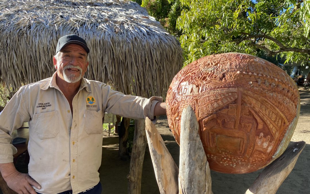
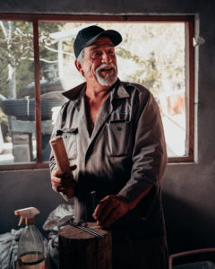 Chito. In Baja California Sur, if you’re talking about Chito, it’s the same as if you were sitting in the offices of Rolling Stone talking about Sting or Bono. Surnames are simply superfluous. Chito is the owner of Rancho Santo Domingo, 2,500 hectares of spectacular land in the Sierra La Laguna mountains that has been in his family since the 1700s. Like most rancheros in Baja Sur, Chito (christened Alfredo Orozco Castro) has all the skills he needs to thrive in a remote area: he knows how to build houses, run a business, train horses, lasso cows, deal with snake bites, make cheese, handle poachers, distill plant-based medicines, fight forest fires, roast pigs and track missing hikers. And that’s just for starters. Ranching has been his way of life, all his life, and when he looks to the future he sees, well, something different.
“Around 35 years ago things started changing,” says Chito. “We used to have rains every January and February, sometimes three times a week, but now we really only have rain during the summer hurricane season. Water, of course, is life, and with this much longer dry season we can’t have as many cows, we can’t make as much cheese, we don’t grow as many vegetables – the impact on the ranching way of life is huge.” Right now selling cows is Chito’s main source of income but, at the age of 60, he’s ready to embrace a post-cow future. “I really see the future of Rancho Santo Domingo in ecotourism.”
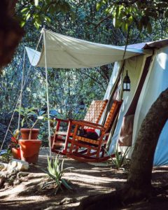 In 2019 Chito started working with Todos Santos Eco Adventures (TOSEA) on a luxury tent camp in the avocado, grapefruit and mango orchard that his grandfather planted for his grandmother at the ranch. (Disclosure: the author is a co-owner of TOSEA). With his own hands he built a traditional ranch kitchen with a beautiful brick, wood-burning stove that is the heart of the camp, and this is complemented by walk-in tents throughout the orchard that feature locally made furniture, real beds, rugs, lamps, rocking chairs and other details that make staying on Chito’s ranch not only incredibly fun, but super comfortable. Chito often guides guests on hikes and mule rides throughout the mountains, and loves chatting with folks around the campfire at happy hour afterwards. His incredibly accomplished 7 year old grandson Alfredito often accompanies him, always making sure that there is enough wood for the stove and always ready to share a laugh with camp guests. Together they demonstrate a truth that has been known in the area for centuries: the ranchers of Baja California Sur are some of the most gracious and welcoming hosts on the planet.
They are also accomplished artists. Using the tools handed down from his father, Chito is a master leatherworker and his beautiful saddles, bridles and other leather items are highly sought after. He is also a natural teacher, and a leather working workshop with Chito is the highlight of many guests’ stay at Camp Cecil de la Sierra, the luxury tent camp on his property.
 Chito inspires his fellow artists as well. Renowned ceramic mosaic artist Donna Billick, the founder of Todos Artes in Todos Santos, was so impressed by the time she spent with Chito that she created the BioSphere, a magnificent ceramic homage to Chito, his ranch, his cowboy roots and his ecotourism future. And she’s not stopping there. Todos Artes artists Isabel “Issy” Von Zastrow and Will Worden will be working with Donna to lead plein aire watercolor workshops at the camp, where visitors can seek inspiration and subject matter from the ranch and the fantastic natural beauty of the area. Alfredito took one of Issy’s first watercolor classes at the camp. He was so impressed that he came back the next day with his cousin Damian and demanded another one. Alfredito’s stated goal in life is to follow in Chito’s footsteps. With his natural gifts for people, ranching and art, we can all look forward to Rancho Santo Domingo’s continued success as a joyful place where visitors can seek respite and inspiration. In the generations to come, ranching ecotourism may well come to be encapsulated in just one name. Alfredito.
by Bryan Jáuregui | Adventure, Arts & Culture, Blog, Conservation, Geology, History, Plants, Ranchero Culture, Sports, Whales, Wildlife
A tumultuous, exhilarating, infuriating and irrevocable shift of population, outlook, culture and vision is sweeping the lower part of the Baja peninsula. Some residents who have been here for a time are eagerly embracing the evolution, spreading the new concepts one joyous Instagram post after another. Others remain faithful to the old days and ways, testily resisting the transformers one grumpy Todos Santos Newsfeed post after another. Who is really a Todos Santeño? Paraphrasing Colson Whitehead’s beautiful tribute to New York, “No matter how long you have been here, you are a Todos Santeño the first time you say, ”That used to be Café Santa Fe” or ”That used to be Santana’s.” … You are a Todos Santeño when what was there before is more real and solid than what is here now….You start building your own private Todos Santos the first time you lay eyes on it.”
For Greg Schredder the first time he laid eyes on Todos Santos was in 1961 from the sea, but he’d been driving down the Baja peninsula for a couple of years by then. “A bunch of us southern California surfers started coming to Baja in 1959” recalls Greg. “Because there was barely a road and certainly no gas stations at that time, we retrofitted our old truck with a custom-built 55-gallon gas tank and brought what we called our Tijuana credit card, a one-inch tube that we’d use for siphoning the gas we bought at the ranches. The ranchers were always incredibly welcoming and ready to help us with gas and anything else we needed. Of course, we didn’t always find them in time and we were often stranded for days. We didn’t care, we were just always looking for waves.”
The fishermen were equally welcoming. “We would travel with 10-pack cartons of unfiltered, Delegado cigarettes, and one carton would get us up to 50 pounds of lobster. Everything was so abundant then. We’d actually get tired of eating lobster and so we’d use it as bait to go fishing. It was not uncommon to see 600-pound groupers in the Pacific lagoons in those days, and the fishermen would actually catch these giants with their hand lines. We loved staying in the fishing villages on these trips. We would surf, dive, fish, and learn incredible stories of these people living in the most remote locations. You could hear your heartbeat for a quarter mile it was so quiet and still. We would always bring baseballs, gloves and Playboy magazines, and we made friends and had a great time everywhere we went.”
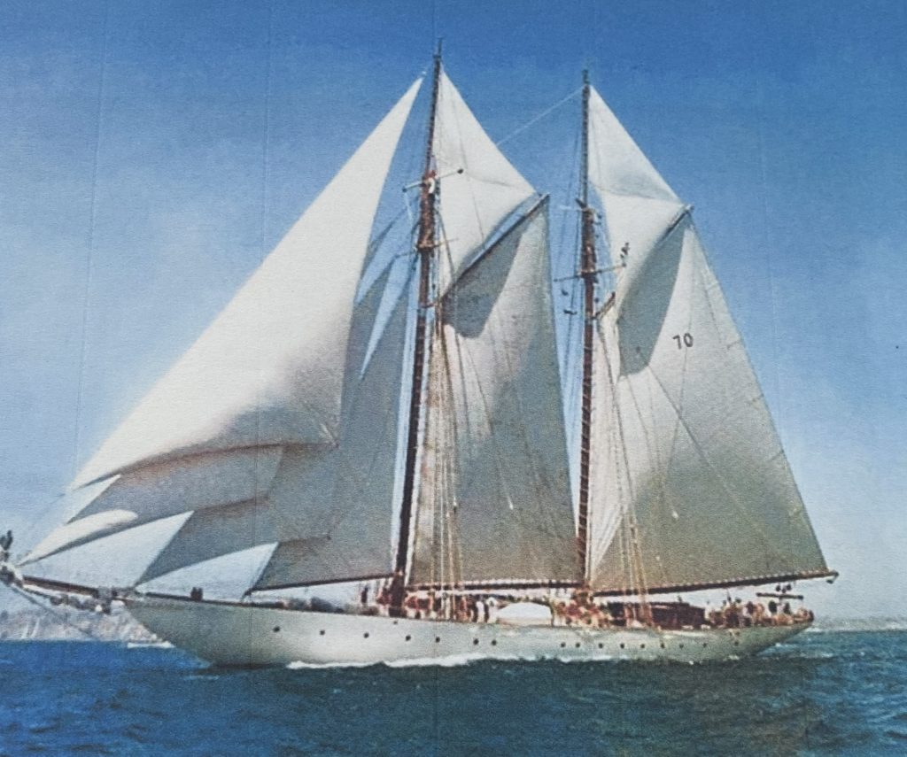
Greg’s introduction to Todos Santos was rooted in much more glamorous transportation than the type that required a Tijuana credit card. “In the 1950s and 60s, most of us surfer kids in Newport, California worked on the yachts of famous people like André Previn, Julie Andrews, and Humphrey Bogart to make money, and they really treated us like family. In 1965 I came to Cabo on Ralph Larrabee’s yacht, Goodwill, and stayed for about a month. At that time Cabo was really just a small village with no electricity. Larrabee’s friends like Donald Douglas (of Douglas Aircraft fame) and John Wayne would fly in to spend a few days partying and fishing, then fly back home. It was during these downtimes that I first explored the Pacific Coast between Cabo and Todos Santos. It was a surfer’s paradise.”
Greg’s friendship with the likes of Douglas and Wayne ended up lasting decades and inspired many of his business ventures across Mexico and Costa Rica. “I would often travel with them over the years, and they are the ones who motivated me to get a real job. As a surfer and diver I decided to set up factories in La Paz and Tijuana to make rubber products related to those activities. We expanded that business into setting up factories for many Fortune 500 companies who needed inexpensive, repetitive labor. We were the largest employer in La Paz and Ensenada for over 20 years. Of course, before the highway came in, it could take up to 2 days to drive to Todos Santos for some surfing.”
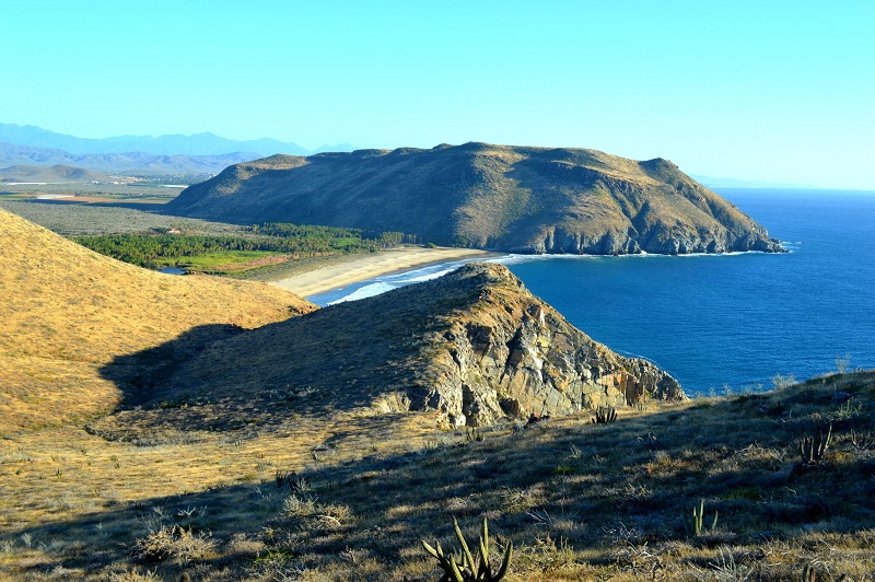
“I have always loved the Pacific side of Baja, and in 1979 I bought Rancho Gaspareño, 50 acres of remote land along a quarter mile of the Pacific coastline, not too far from Todos Santos. One of the people who drew me to the area was Carmen Salgado Agramont. She had a little cantina with a hitching post out front for horses where she’d serve up warm beer and hot food. She was quite savvy, and bought the first gas refrigerator in the area. She almost couldn’t keep up with ranchero demand for cold beer after that, and there were always dozens of horses around her cantina. I loved that place, and it was Carmen’s son who set me on the path to buying the ranch, which actually has the name and signature of Benito Juarez on the original land grand title. Since then I’ve been growing coco palms on the ranch, and have also been experimenting with growing plants from Hawaii like breadfruit that have excellent potential in Mexico.”
Greg loves the history of the area. “Rancho Gaspareño was named after a Spanish galleon that went aground on the point, the Gaspareño. It was one of the so-called Manila galleons, Spanish ships that sailed between the Philippines and Acapulco for 250 years, bringing spices, silks and other luxuries from the far east to New Spain. All these galleons sailed the Pacific coast of Baja on their way to Acapulco, so naturally enough the area became riddled with pirates, many of them English and Dutch. There are many tales of buried pirate treasure in the area, and local school groups still come to explore the cave at Rancho Gaspareño each year to tap into the lore. Treasure hunters have reason for optimism; in 1974 when the road from La Paz to the ferry terminal at Pichilingue was being built, a pirate chest of plundered loot was discovered by road workers.”
“I think of this part of the Baja coastline as the forgotten area” continues Greg. “People drive past Rancho Gaspareño going a hundred miles an hour on the new 4-lane highway and have no idea of the history of the area.” The Guaycura and Pericue Indians were the original inhabitants before the Jesuit’s arrival in 1697, and they were essentially wiped out by the time the Jesuits left in 1768. The Jesuits built their theocracy based on a promise to the King of Spain to get rid of the pirates who were plundering his ships, and the pirates faded away with the demise of the Manila galleons in 1815. Dominican Padre Gabriel González had a ranch near Gaspareño from 1825 to 1850, and the tobacco, rum, sugar, corn, and livestock he produced there made him the richest man in Baja California. From his ranch the padre engaged in espionage and guerilla warfare during the Mexican-American war of 1846-1848, and – thanks in part to the Padre – Mexico won a major victory near Gaspareño (but lost the war). By 1855 the Padre had lost his political backing and left Baja for good. For the next one hundred years entrepreneurs made fortunes in the sugar cane industry with fields in areas like Gaspareño, but in the 1950s a severe drought and price drop lead to the demise of the industry; the last sugar processing plant closed in 1974. In that same year the trans peninsular highway made its way to Todos Santos, bringing new life to the town, and in 1985 renowned artist Charles Stewart arrived from Taos, planting the seed for Todos Santos’ current incarnation as an artists’ colony. It remains an agricultural center and surfing hotspot, only now it is firmly on the radar of major developers.
62 years after his first trip down the Baja peninsula, Greg is ready to carve out a little hacienda for himself and his art collection, but let someone else take over the bulk of the land that is Rancho Gaspareño. He has kept his 50 acres wild and free, but would love to see someone with vision and passion create a place of beauty that celebrates the area’s thrilling past, and embraces an artistic, sustainable future. Someone who started building their own private Todos Santos the first time they laid eyes on it.
Of course, letting go of a big piece of the ranch is bittersweet for Greg. Paraphrasing Colson Whitehead’s tribute to New York once more, “We can never make proper goodbyes… Maybe we become Todos Santeños the day we realize that Todos Santos will go on without us. …. Naturally we will cast a wary eye toward those new kids on the block, but let’s be patient and not judge too quickly. We were new here, too, once.” Yes indeed. A tumultuous, exhilarating, infuriating and irrevocable shift of population, outlook, culture and vision is sweeping the lower part of the Baja peninsula. It always has.
by Bryan Jáuregui | Blog, Education, Geology, Information
by Bryan Jáuregui for the Journal del Pacifico
These days when you visit the Baja peninsula and the Gulf of California things can seem slow, lazy, sometimes as if not even time is moving. It is the moment, it is Zen, it is calm. This is not how things started. Baja and the Gulf of California were born from crashing tectonic plates, erupting volcanoes and the violence of geology. They were created quickly, in the blink of an eye, and not very long ago. Geologically speaking.
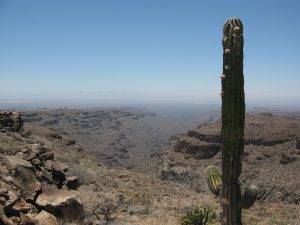
Dr. Scott Bennett of the US Geological Survey has studied the geology and tectonics of Baja California for years and published numerous scientific research articles on the formation of the peninsula and the Gulf of California. He lays out the process of their short, intense creation, and where you can identify pieces of the birth story on your travels throughout Baja. “100 to 80 million years ago (Cretaceous period), a subduction zone existed along the western edge of North America, including Mexico. The Farallon and North American plates were moving towards each other, with the Farallon plate subducting underneath the North American plate, heading down to the east. This subduction motion (writer’s note: some might modify “motion” with adjectives like smashing, hurdling, crashing) formed ancient volcanoes at Earth’s surface, and large batholiths of granite in the magma chambers below. Then 50 to 40 million years ago, the angle of the down-going Farallon plate seemingly shallowed, causing mountains, such as the Rockies in the USA and the Sierra Madre Oriental in Mexico, to shoot up throughout Western North America. This uplift, and the related erosion (which erased the previously formed volcanoes) brought the older granite rocks to the surface. These are the rocks that you see today stretching for miles as you travel through the Valley of the Cirios (Valle de los Cirios) in the mid-section of the peninsula, on Highway 2 between Tijuana and Mexicali, and in the Sierra La Laguna mountains between Todos Santos and San Jose del Cabo.”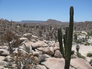
Now it may seem to our human mindset that this all took place an exceedingly long time ago. But to understand just how young the Baja peninsula really is, consider that those who know how to calculate such things say that Earth is 4.54 billion years old, give or take 50 million years. That is to say, most of the action that formed the land of the Baja peninsula took place in the period of time that correlates to a margin of error for the formation of Earth. And we’ve only gotten to the granite and the mountains. What is now the Baja peninsula was still firmly attached to mainland Mexico, and the Gulf of California was not even a twinkle in the Pacific Ocean’s eye.
 “Then 25 to 12 million years ago (Miocene period), the Farallon Plate in the Pacific Ocean started subducting east at a much steeper angle again, like a curtain whipping downwards” says Scott. “This steepening angle created more volcanoes, but their location shifted back to the west, tracking with the ever-steepening, subducting Farallon plate. The volcanic rocks from this period make up a lot of the flat top mesas that you see in Baja California today in areas like Cataviña and La Purisima, as well as the massive piles of volcanic rock in the high peaks of Sierra Madre Occidental in Sonora, Sinaloa and Nayarit. The Tres Virgenes Volcanoes, in the midsection of the Baja peninsula, were formed at the end of this period. Isla Espiritu Santo, off the coast of La Paz in the Gulf of California, gets its striking beauty from the wonderfully layered volcanic rock, mostly tuff (rocks made of compressed volcanic ash), that has been gently tilted along normal faults. Brian Hausback, a geology professor at California State University, Sacramento, has dated some of the volcanic rocks of Isla Espiritu Santo to 16-21 million years old, making them older
  than the formation of the Gulf of California seaway.”
Which means that, at this point in our story, the Baja peninsula is still stubbornly connected to the mainland. But we’re getting to the good part now!
“Then, 12 million years ago, the conveyor belt of subduction stopped” say Scott. Plates stopped colliding and the volcanoes slowly waned. There was calm. But then, thanks to a complex reorganization of tectonic plate motions, a new phenomenon emerged: oblique rifting. The plates began pulling apart, but at an oblique angle. Scott continues. “This oblique rift is called the Gulf of California Shear Zone. It became connected with the southern end of the San Andreas fault near the Salton Sea, which now made its way to Mexico. This resulted in right lateral fault motion in northwestern Mexico, and everything to the west of it began ripping away from the mainland, moving to the northwest, including the sliver of California that is to the west of the San Andreas fault – San Diego, Los Angeles, Big Sur, Santa Cruz. The area that is now San Jose del Cabo wrenched away from the area that is now Puerta Vallarta, and the formation of the Baja peninsula was in motion.” At last!
The rest of it didn’t take long. By 8 million years ago the rate of ripping (oblique rifting) increased and the Gulf of California seaway (finally!) started to form, with the waters of the Pacific Ocean trickling up to somewhere around La Paz. By 7 million years ago the Gulf of California seaway had trickled up to Guayamas, and by 6.3 million years ago the gulf waters had gone all the way up to the Salton Sea region, forming an extremely long and skinny Gulf of California seaway from Cabo to southern California that was probably no more than 10 to 50 kilometers wide and well over 1,000 kilometers long.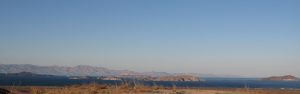
Of course, no current map shows the Gulf of California connected to the Salton Sea, and for that we can thank the Colorado River. About 5.5 million years ago it started flowing into the low-lying areas at the northern end of the Gulf of California (which was rapidly rifting apart) and forming large tectonic valleys that are similar to Death Valley today. The Colorado brought with it an enormous amount of sand and silt that essentially filled up the tectonic valleys across the entire area from the Salton Sea to the current Gulf of California, forming an agricultural river delta between Mexicali and Yuma. When you look at Google Map imagery of the Gulf of California today, you can clearly see the smooth, sandy bottom that characterizes the seafloor in the northern part of the gulf where the Colorado River deposited sand and silt, in contrast to the jagged and faulted continental remnants that characterize the seafloor in the central and southern Gulf, from about Bahia Los Angeles on down. The whole story is written right there on the seabed.
And the story is not over yet. The Gulf of California is still rifting apart, and the Baja peninsula continues its journey to the northwest, moving away from mainland Mexico at about 45 millimeters per year, although sometimes much faster. Observes Scott, “We are constantly reminded of the active tectonic plates in the Gulf of California by large earthquakes of Magnitudes 4 to 6 that occur in the Gulf every year. The most recent large earthquake (M7.2) occurred in northeastern Baja California on Easter Sunday 2010, tearing a 120-kilometer gash across Earth’s surface, and moving the Baja peninsula several feet towards the northwest in less than a minute.”
Baja’s journey will continue. Along with the southern parts of the US state of California that are to the west of the San Andreas fault, Baja will continue to travel roughly 50 kilometers every million years, eventually sliding past Vancouver and Juneau and colliding with Anchorage in 50 million years or so. Which, remember, is just the margin of error for the age of Earth. We are practically there.
© Copyright Sergio and Bryan Jauregui, Casa Payaso S de RL de CV, 2019
