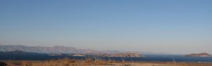
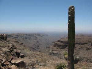
These days when you visit the Baja peninsula and the Gulf of California things can seem slow, lazy, sometimes as if not even time is moving. It is the moment, it is Zen, it is calm. This is not how things started. Baja and the Gulf of California were born from crashing tectonic plates, erupting volcanoes and the violence of geology. They were created quickly, in the blink of an eye, and not very long ago. Geologically speaking.
Dr. Scott Bennett of the US Geological Survey has studied the geology and tectonics of Baja California for years and published numerous scientific research articles on the formation of the peninsula and the Gulf of California. He lays out the process of their short, intense creation, and where you can identify pieces of the birth story on your travels throughout Baja. “100 to 80 million years ago (Cretaceous period), a subduction zone existed along the western edge of North America, including Mexico. The Farallon and North American plates were moving towards each other, with the Farallon plate subducting underneath the North American plate, heading down to the east. This subduction motion (writer’s note: some might modify “motion” with adjectives like smashing, hurdling, crashing) formed ancient volcanoes at Earth’s surface, and large batholiths of granite in the magma chambers below. Then 50 to 40 million years ago, the angle of the down-going Farallon plate seemingly shallowed, causing mountains, such as the Rockies in the USA and the Sierra Madre Oriental in Mexico, to shoot up throughout Western North America. This uplift, and the related erosion (which erased the previously formed volcanoes) brought the older granite rocks to the surface. These are the rocks that you see today stretching for miles as you travel through the Valley of the Cirios (Valle de los Cirios) in the mid-section of the peninsula, on Highway 2 between Tijuana and Mexicali, and in the Sierra La Laguna mountains between Todos Santos and San Jose del Cabo.”
Now it may seem to our human mindset that this all took place an exceedingly long time ago. But to understand just how young the Baja peninsula really is, consider that those who know how to calculate such things say that Earth is 4.54 billion years old, give or take 50 million years. That is to say, most of the action that formed the land of the Baja peninsula took place in the period of time that correlates to a margin of error for the formation of Earth. And we’ve only gotten to the granite and the mountains. What is now the Baja peninsula was still firmly attached to mainland Mexico, and the Gulf of California was not even a twinkle in the Pacific Ocean’s eye.
“Then 25 to 12 million years ago (Miocene period), the Farallon Plate in the Pacific Ocean started subducting east at a much steeper angle again, like a curtain whipping downwards” says Scott. “This steepening angle created more volcanoes, but their location shifted back to the west, tracking with the ever-steepening, subducting Farallon plate. The volcanic rocks from this period make up a lot of the flat top mesas that you see in Baja California today in areas like Cataviña and La Purisima, as well as the massive piles of volcanic rock in the high peaks of Sierra Madre Occidental in Sonora, Sinaloa and Nayarit. The Tres Virgenes Volcanoes, in the midsection of the Baja peninsula, were formed at the end of this period. Isla Espiritu Santo, off the coast of La Paz in the Gulf of California, gets its striking beauty from the wonderfully layered volcanic rock, mostly tuff (rocks made of compressed volcanic ash), that has been gently tilted along normal faults. Brian Hausback, a geology professor at California State University, Sacramento, has dated some of the volcanic rocks of Isla Espiritu Santo to 16-21 million years old, making them older than the formation of the Gulf of California seaway.”
Which means that, at this point in our story, the Baja peninsula is still stubbornly connected to the mainland. But we’re getting to the good part now!
“Then, 12 million years ago, the conveyor belt of subduction stopped” say Scott. Plates stopped colliding and the volcanoes slowly waned. There was calm. But then, thanks to a complex reorganization of tectonic plate motions, a new phenomenon emerged: oblique rifting. The plates began pulling apart, but at an oblique angle. Scott continues. “This oblique rift is called the Gulf of California Shear Zone. It became connected with the southern end of the San Andreas fault near the Salton Sea, which now made its way to Mexico. This resulted in right lateral fault motion in northwestern Mexico, and everything to the west of it began ripping away from the mainland, moving to the northwest, including the sliver of California that is to the west of the San Andreas fault – San Diego, Los Angeles, Big Sur, Santa Cruz. The area that is now San Jose del Cabo wrenched away from the area that is now Puerta Vallarta, and the formation of the Baja peninsula was in motion.” At last!
The rest of it didn’t take long. By 8 million years ago the rate of ripping (oblique rifting) increased and the Gulf of California seaway (finally!) started to form, with the waters of the Pacific Ocean trickling up to somewhere around La Paz. By 7 million years ago the Gulf of California seaway had trickled up to Guayamas, and by 6.3 million years ago the gulf waters had gone all the way up to the Salton Sea region, forming an extremely long and skinny Gulf of California seaway from Cabo to southern California that was probably no more than 10 to 50 kilometers wide and well over 1,000 kilometers long.
Of course, no current map shows the Gulf of California connected to the Salton Sea, and for that we can thank the Colorado River. About 5.5 million years ago it started flowing into the low-lying areas at the northern end of the Gulf of California (which was rapidly rifting apart) and forming large tectonic valleys that are similar to Death Valley today. The Colorado brought with it an enormous amount of sand and silt that essentially filled up the tectonic valleys across the entire area from the Salton Sea to the current Gulf of California, forming an agricultural river delta between Mexicali and Yuma. When you look at Google Map imagery of the Gulf of California today, you can clearly see the smooth, sandy bottom that characterizes the seafloor in the northern part of the gulf where the Colorado River deposited sand and silt, in contrast to the jagged and faulted continental remnants that characterize the seafloor in the central and southern Gulf, from about Bahia Los Angeles on down. The whole story is written right there on the seabed.
And the story is not over yet. The Gulf of California is still rifting apart, and the Baja peninsula continues its journey to the northwest, moving away from mainland Mexico at about 45 millimeters per year, although sometimes much faster. Observes Scott, “We are constantly reminded of the active tectonic plates in the Gulf of California by large earthquakes of Magnitudes 4 to 6 that occur in the Gulf every year. The most recent large earthquake (M7.2) occurred in northeastern Baja California on Easter Sunday 2010, tearing a 120-kilometer gash across Earth’s surface, and moving the Baja peninsula several feet towards the northwest in less than a minute.”
Baja’s journey will continue. Along with the southern parts of the US state of California that are to the west of the San Andreas fault, Baja will continue to travel roughly 50 kilometers every million years, eventually sliding past Vancouver and Juneau and colliding with Anchorage in 50 million years or so. Which, remember, is just the margin of error for the age of Earth. We are practically there.
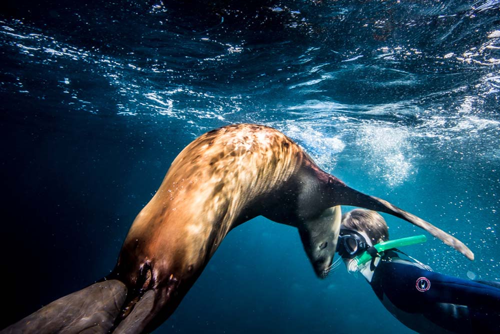
Swimming with the sea lion puppies at Los Islotes, the southernmost rookery of the California Sea Lion, Zalophus californianus, is truly one of life’s great joys. The puppies are often playful and naughty, nibbling on the flippers and fingers of human visitors, while their teenage siblings like to sidle up to humans for a good belly rub or game of chase. Their mothers may be found sunning themselves on the rocks, enjoying a snooze, while the males who rule the 20 territories of Los Islotes indefatigably patrol the waters to ensure everyone’s safety. It is a scene of utter Baja bliss, and humans can’t help but feel a magical glow from this most wondrous of wildlife encounters.
All of which begs the obvious question: Why are the males working so hard when everyone else is just having a good time?
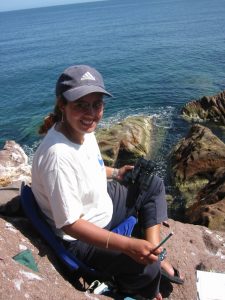
Claudia J. Hernandez-Camacho, a professor of biology at CICIMAR in La Paz, has been studying the sea lions of Los Islotes and the Sea of Cortez since 1990. In particular, she has studied the entire lifespan of 190 sea lion individuals (94 females, 96 males) who were hot-branded by her professor between 1980 and 1984. Her findings, based on these specific sea lions and others, tell a complicated tale for our pinniped friends.
“Sea lions are polygynous, meaning that one male mates with several females in the territory that he defends on land and sea. It takes an enormous amount of energy to defend this territory, and in the breeding season a territorial male, who is so focused on his job that he barely eats or sleeps, can lose up to 30% of his impressive body weight (400 to 500 kilos, or about a ton) in just a few weeks.”
Photo by Colin Ruggiero for Todos Santos Eco Adventures
One would assume, of course, that the males are spending this incredible amount of energy to defend their harems and offspring, to ensure the survival of their genes. “But this is not exactly the case” says Claudia, “they are defending the territory, not the females.” The science proves this out. “Genetic studies show that just 15% of territorial males are the fathers of the newborns the next breeding season. It is not just that the females hook up with and get impregnated by wandering, opportunistic males when they slip off for their 4-5 day feeding trips, which they do, but in some cases the territorial males are not even copulating with the females in their territory.” All that work and no sex?
“It’s a little more complicated than that,” says Claudia. “There are 600 individual sea lions at Los Islotes, and every year around 170 pups are born. Almost 30% of the pups die in the first two years, either from disease or because they or their mothers have fallen prey to predators. But that means that 70% are surviving. With this type of situation, many of the sea lions are, by definition, related. It could be argued that the Los Islotes males work so hard not just for their own offspring, but because they are protecting their extended families. This would also explain why they do not copulate with all the females in their territory. They are avoiding inbreeding.” This is an approach to collective living that we generally only associate with high intelligence mammals like primates, elephants and dolphins.
The Los Islotes territorial males are so successful in their defense of the colony, and have made conditions so conducive to survival, that Los Islotes is actually full to capacity now. In fact, two new satellite colonies have been created nearby in recent years by all the young males who are no longer welcome at Los Islotes, but who are still too young and slight to fight older, larger males for territory. Sea lions are philopatric, meaning that they stay in or habitually return to the area of their birth, so it is possible that these satellite colonies will only continue to grow.
What makes this all the more remarkable is that it is happening at a time when the overall population of California Sea Lions in the Sea of Cortez is dropping dramatically. Between 2000 and 2018, 40% of the population of other colonies disappeared. Are those males falling down on the job? Not likely says Claudia. “We are analyzing a lot of
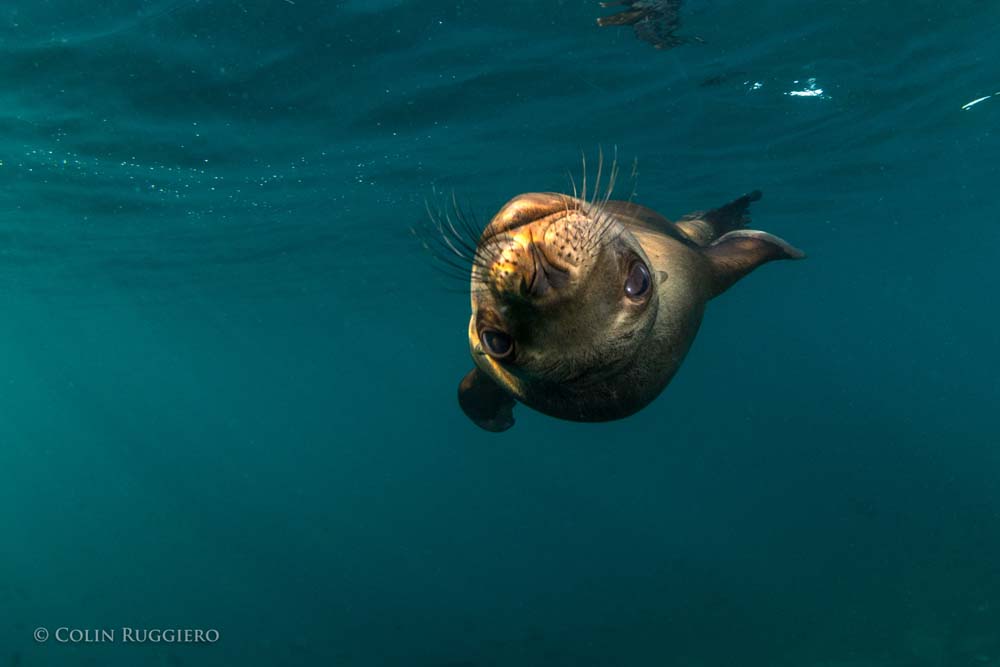
Photo by Colin Ruggiero for Todos Santos Eco Adventures
environmental variables right now to determine the main factor causing the decline of these colonies, but one of the most likely culprits is the food supply” she observes. “It is not that the fish populations in the other parts of the Sea of Cortez are declining, they are not. It is that the fish are moving further south. While the sea lions of Los Islotes, the southernmost California Sea Lion rookery, are benefitting from this trend, it is proving lethal to others. Healthy females will travel up to 60 kilometers away from their colonies to find food, but further than that is not feasible. They need to conserve energy to produce milk for their pups. And even in those more northern locations where there are still fish, there are a very limited number of fish species, and this relatively poor-quality diet means that the females are not gaining enough energy from their food to productively nurse their pups. On the opposite side of the coin, the sea lions of Los Islotes are getting an increasing number of fish species in their diet, with the result that population density has reached an all-time high.”
Female sea lions are not only philopatric, i.e., prone to stay in the area where they were born, they are attached to very specific real estate in that area, with many staking one specific rocky outcropping for their own. So with the increasing density of the population at Los Islotes, it is not surprising to learn that sea lion attitudes are becoming a bit more aggressive. Add to that the fact that the entire colony of females either a) goes into estrus, or b) has newborn pups to defend at exactly the same time and breeding season, which generally takes place June 1 to August 31, becomes a time when human body parts might best be kept at a distance from the sea lions of Los Islotes. In fact, Los Islotes is now closed to snorkelers and scuba divers during this period.
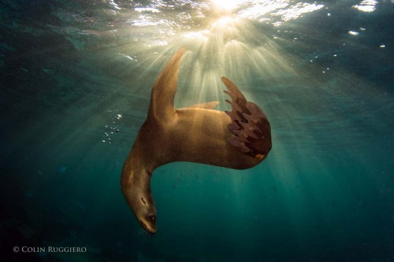
Los Islotes is regularly listed as one of the top diving/snorkeling spots in the world, and Claudia and her students are launching a study to evaluate the effects of all these visitors on the sea lions. The tourism hiatus being imposed by the authorities during breeding season offers them the perfect opportunity for their research. “We have already collected fecal samples from the sea lions during the tourist season, and will now do so again when the colony is closed to tourists. We will then test the level of cortisol, a stress indicator, in both sets of fecal matter to determine if tourism increases stress in sea lions. We have already observed some differences in behavior in the sea lions at Los Islotes. While at other, more remote colonies, the sea lions will copulate during the day, at Los Islotes they only engage in this behavior at night. We hope to be able to determine if tourism is having an impact on the sea lions.”
Claudia at Los Islotes
Of course, liking your loving in the evening time is a common enough attribute of many healthy mammals, but if other colonies are also enjoying some afternoon delight, have the sea lions of Los Islotes gone too far in adapting to the presence of humans? Will the territorial males one day snap back to impose a more natural environment for their territories? Human males have certainly done battle over lesser issues.
Tourists have been visiting Los Islotes on a regular basis for roughly three decades, and sea lion males live an average of 19 years. There is therefore not yet a deep institutional knowledge about humans among the territorial males, and they could still be giving us the opportunity to demonstrate our worthiness as visitors to their home. Will we make the cut? We can’t be sure what the sea lions have learned about humans over the years, or what Claudia and her team will demonstrate, but the strong pull of Los Islotes on humans is easy enough to understand: it is a place where joy and spontaneity rule, and we thrill to that vibrancy. While the territorial males are likely not motivated by their roles as life coaches for humans, it is enticing to think that maybe just one of the reasons they work so hard is to protect such a joyful lifestyle for their families. Claudia and her team are working hard to do the same.
VISIT WITH CLAUDIA AND HER TEAM!
Todos Santos Eco Adventures is the leading eco adventure company in Baja California Sur. On Isla Espiritu Santo we operate Camp Cecil, a luxury tent camp, and Camp Colossus, a moveable glamping operation. Claudia and her students will be spending time with us at our camps throughout the season as they conduct their sea lion research, so you may find them at the dinner table if you spend time with us at the island!
There’s a sucker born every minute. That’s right. There’s a high possibility that you are personally a sucker, an even greater probability that most of your extended family members are suckers, and it is almost certain that your circle of friends and acquaintances suck too. How could we know such a thing? Simple mathematics. The United States is home to roughly 325 million people, yet the country uses 500 million plastic straws per day. That is to say, each person is using an average of 1.5 plastic straws per day. And that’s just one country. As a species, we suck on a global scale.
Of course, the thing that really sucks is that a huge percentage of these plastic straws are ending up in our oceans. The Earth Institute of Columbia University estimates that the Great Pacific Garbage Patch is twice the size of the continental United States. Of all that garbage, an Ocean Conservancy study concludes that fully 60% of it consists of items that society terms “disposable”, plastic bags, food containers, plastic bottles and plastic straws. The Ocean Conservancy estimates that a plastic straw, used for 15 to 30 minutes to consume one drink, can take up to 100 years to decompose. A plastic bag that you use for 15 minutes to transport your purchase from store to home can take 150 years to decompose. Plastic bottles can take up to 450 years.
So, that sucks, but why should us suckers care? Turns out plastic, it’s what’s for dinner. A recent study by the Ryan Institute concludes that 70% of fish in the North Atlantic have ingested plastic. Another study by Ghent University in Belgium estimates that shellfish lovers are eating upwards of 11,000 plastic fragments in their seafood each year. That plastic straw that seemed so harmless in your drink at lunch could actually come back to haunt you in your seafood dinner. And that’s the thing: plastic is personal. Which is why towns across Baja California Sur, including Todos Santos, Pescadero, La Paz, Cabo Pulmo and Los Barriles are taking a stand against plastic straws and other single-use plastics. Baja is a strip of land bounded by two oceans, so what we do in our towns has an immediate impact on our oceans.
Baja is the place where 5 of the world’s 7 turtle species come to nest (sea turtles mistake plastic bags for their favorite food, jelly fish, and die from ingesting the plastic; plastic straws also get stuck in their nostrils and air passageways), it is home to 39% of the world’s total number of marine mammal species (sea lions and others are getting entangled in plastic bags and packing bands, and dying from infection or strangulation), it is where one third of the world’s whale and dolphin species spend their time (a dead sperm whale was recently found with 29 kilos of plastic in its stomach), it is a critical part of the Pacific flyway and home to over 430 bird species (National Geographic states that 90% of sea birds are ingesting tiny bits of plastic that they lethally mistake for food), and the Sea of Cortez alone is the home of 891 fish species that supply over half of Mexico’s fisheries, from whence we get our seafood dinners. So ridding the area of single-use plastics is a deeply personal matter for residents of Baja. Says Mayra Victoria Gutierrez Sandoval, leader of the Déplastificate movement in Baja Sur, “Every time you personally consume a piece of plastic, you have to be personally responsible for what happens to it. That is the only way to eradicate the problem.”
Teresa Egea, Gardens, Sustainability & Spa Director at the hotel Rancho Pescadero and its Garden Restaurant, firmly believes in taking personal responsibility for reducing the use of plastics. “My philosophy is to practice the R’s, which are not only reduce, reuse, and recycle, but also reinvent and redistribute. I came to Rancho Pescadero 6 months ago and wanted to reinvent the use of the popote. Our mixologist is from Oaxaca, where he developed a project of plant-based straws created by local communities with local plants, specifically Arundo donax, a type of cane. These straws are very beautiful, washable and reusable and our guests love them, not only because they are enjoyable to use, but because they represent a sustainable alternative to plastic, and redistribute income away from plastic producers to local communities. Moreover, since we switched from plastic straws to the cane straws, our straw costs have declined by 2.5 times – it is a very profitable option and therefore a sustainable option for the business as well.”
Marimar Higgins, owner of La Esquina restaurant in Todos Santos, has long been a proponent of no popotes and eliminating single-use plastics. “We are serving straws less and less, and the ones we do serve are made out of paper. Almost all of our to-go containers are biodegradable, and we charge 5 pesos for all to-go items to make people think twice before taking away.” Michael and Pat Cope of Michael’s at the Gallery gave up popotes and plastic water bottles long ago as well. Reflecting on such trends, Jürg Wiesendanger, owner of Hotel Posada La Poza says of the Déplastificate movement in Baja, “It is like banging on an open door.” And that is the exciting thing. While the movement to rid Baja of single-use plastics is gaining new momentum, restaurants like Posada La Poza’s El Gusto! gave up plastic straws a while ago, and are currently evaluating how best to continue their forward momentum. Plenty of local companies are charging ahead. Alma and Manny’s, a much-loved local restaurant, stopped giving patrons plastic straws a year ago. New fish taco restaurant Santo Chilote not only doesn’t offer popotes to its patrons, it offers a discount to diners who bring their own takeaway containers. Landi Ortega eliminated popotes at her restaurant, Landi’s, over a year ago, Chef Sergio Rivera eliminated them from his restaurant La Casita a month ago, the Hotel Guaycura and its restaurants are celebrating their first popote-free season, and El Refugio owner Rachel Glueck has never had a popote on her premises. Feliz Ramon Vazquez Guluarte recently implemented a new program at his coffee shop, Cafélix, and now uses only compostable straws and glasses and environmentally-friendly take-out containers. Joella Parsons, owner of Pura Vida, is doing the same. Other businesses like La Morena, Fonda El Zaguán, La Santeña, Que Rico, Gallo Azul, Caffe Todos Santos, Café Santa Fe, Los Adobes and Cerritos Surf Town are actively working on their strategies for eliminating single-use plastics.
The Todos Santos Restaurant Association is totally committed to the movement. “To protect our oceans, sea turtles and other marine life, each restaurant that belongs to our association is committed to eliminating the use of plastic straws as a first step to becoming “green” restaurants. Our goal is to replace all single-use plastics with products made of compostable materials. The restaurant industry is united with the other sectors to make Todos Santos a town without single use plastics.”
That, most emphatically, does not suck! So next time you’re in a restaurant in Baja California Sur, don’t be a sucker. Ask for your drink “Sin popote por favor”. The turtles thank you!
RESOURCES FOR LOCAL BUSINESSES AND COMMUNITY MEMBERS:
• For more information on the Déplastificaté movement in BCS please visit their Facebook page at: https://www.facebook.com/DesplastificateMX/
• If you’re a local business looking for suppliers of non-plastic solutions to your business needs, and/or artwork and other informational tools for your employees and clients, please email Mayra Gutierrez at or Bryan Jáuregui at
• For recycling solutions in Todos Santos and Pescadero, please contact Alex Miró at: https://www.ecorrrevolucion.org
The National Geographic Society, as venerable an institution as ever graced the shores of the North American continent, has an image problem. Since 1888 the NGS has been supporting adventurers and explorers of every stripe across all the corners of the globe, and such is their success that it is now safe to say that we know it all. Satellites and surveyors, exploring on the ground and from the air, have neatly filled in all the spaces on the old maps where there used to exist nothing but the terrifying admonition: Here be dragons! Does this mean that the Age of Exploration is dead? Is there no more geography left around which a society can coalesce for discovery? Is the NGS, as some naysayers opine, obsolete?
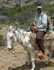
Dr. Jon Rebman in the Sierras
Not a chance. A glance at the interactive NGS global explorers map, which shows thousands of explorers engaged in equally numerous projects across our well-mapped continents, definitively lays that notion to rest. A zoom from the global view of the map down to our own Baja California Sur shows just how vibrant an era of discovery we inhabit. Here you’ll find a hiker symbol in the Sierra La Laguna mountains just outside of Todos Santos, which is the avatar for NGS explorer Dr. Jon P. Rebman, director of the San Diego Natural History Museum’s Botany Department, and author of the definitive Baja California Plant Field Guide. Dr. Rebman’s work demonstrates not only that the Age of Exploration is alive and well, but that we are always gaining a deeper knowledge of the areas depicted on our maps. Perhaps more importantly, we are conserving the existing knowledge of these areas that is in danger of slipping away.
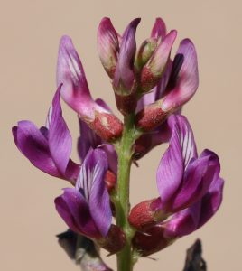
Explains Dr. Rebman. “After 20 years of floristic research on the Baja California peninsula and adjacent islands, my colleagues and I created an annotated, voucher-based checklist of the vascular plants of Baja California. We published this in 2016, and when we compared it to the only floristic manual for the entire Baja California region published by Wiggins in 1980, we found that we had added more than 1,480 plant taxa to the area, including approximately 4,400 plants (3,900 vouchered taxa plus 540 reports), of which 26% are endemic to the region. As part of this process we identified several plants in Baja California that are very rare and only known from one to very few collections.”
“We got focused on the need for conservation efforts to protect the region’s rare flora during a November 2013 expedition in the Cabo Pulmo area to document biodiversity in an area slated for development. My colleagues and I documented two plant species that had been lost, meaning not collected or scientifically documented, for decades. One of these rediscoveries was Stenotis peninsularis (Rubiaceae), a micro-endemic species that was last collected in 1902 by T.S. Brandegee. Yes, that means we had not seen this species in over 110 years!”
Inspired, Rebman continued his quest for the lost plants of Baja during a workplace re-assignment from San Diego to La Paz August 2015 to June 2016. Working with local Baja botanists, he rediscovered approximately 50 plant species in the Cape region that were known from just one, or a tiny number, of historical specimens. But there were more. Specifically, there were 15 more “lost” plants, all endemic to the Baja California peninsula, that had been collected between 1841 and 1985, but had not been seen since. Rebman was intent on finding them. “With the ever-increasing detrimental impacts to native plants and natural landscapes, I realized that the time was now to attempt to re-discover some of Baja California’s very rare, unique, and presently “lost” plants before they are gone forever.” The National Geographic Society agreed to fund the project, and Rebman got his Mexican colleagues – Dr. Jose Luis Leon de la Luz, Dr. Alfonso Medel Narvaez, Dr. Reymundo Dominguez Cadena and Dr. Jose Delgadillo – to join the effort. But how do you find a “lost” plant? It’s not for the faint of heart – spiritually, physically, or intellectually-speaking.
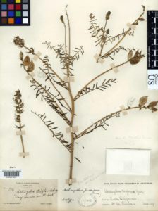
Astragalus piscinus: an image of the holotype specimen deposited in the united States national Herbarium (uS) at the Smithsonian.
Consider. In March 1889, self-taught British botanist Edward Palmer disembarked from a boat at a place on the Baja peninsula that he called “Lagoon Head”, found what he thought was a common weedy plant, and deposited it in an herbarium without further ado. Sometime later, renowned American botanist Marcus E. Jones found it in the herbarium, realized it was a very rare, endemic Baja California plant species, named it Astragalus piscinus, (common name Lagoon Milkvetch), and that was the last time anyone recorded it. In 1884 noted California naturalist Charles Orcutt was in a place he christened “Topo Canyon” when he chanced upon the very rare Physaria palmeri, took a sample, and recorded it with the fledgling San Diego Natural History Museum. No one has noted a sighting of it since. The entire list of the 15 lost plants Rebman and his colleagues set out to find reads like this, with very precise information about the plant, but incredibly imprecise information about the location. Therefore, the first thing the team had to do was pore over the papers, books and letters of the botanists who originally discovered the plants, and do their best to figure out where, exactly, in this 1,000 mile long peninsula, these botanists were when they took their samples. As a result, one of the cool byproducts of the expedition is a map put together by the NGS team that shows the place names used by these early botanists with the actual place names in use today. As every good cartographer knows, maps are an ever-evolving business.
The team narrowed down the possible locations for each plant (“Lagoon Head” turns out to be near Scammons Lagoon and “Topo Canyon” in the mountains of northern Baja), but then they had to actually find these very rare plants in an area that they had already demonstrated held over 4,400 different plants. It would seem almost impossible to make any progress while stopping to investigate all the different possibilities. Unless, of course, you are already so familiar with all the plants that you can immediately discern the one you don’t know, the one you’ve only seen as a specimen or a drawing. John Rebman and his Mexican botanical collaborators are quite possibly the only people alive today to stand a chance of finding any single one of these 15 lost plants. Yet so far, they have looked for ten and found seven. For the others, they need to wait for rain, in Baja, to find the blooms.
“It has not been easy” remarks Rebman. “We were in a desolate area in northern Baja where bandits are known to congregate, and I was looking for Orcutt’s
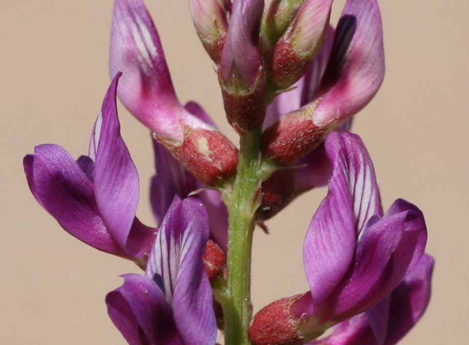
Astragalus piscinus flowers. Photo by Jon Rebman
Physaria palmeri. There were signs that the bandits were around, and alarm bells were going off in my head. But I had read Orcutt’s journals, had a firm sense of where he had been the day before he discovered the plant as well as the day after, and I really believed I was close. Yet I kept not finding the plant and kept getting more nervous. Finally, I decided that if I hadn’t found it by the time I reached the next tree, I would turn around. I got to the tree, got off my horse, looked down, and there it was. Orcutt, probably found it when he stopped to take a break in a shady spot all those years ago.”
Finding each of the 7 plants they’ve recovered so far has required serious expeditionary skills and effort, with horses, burros, camping gear, local guides, packed water and food. It’s been hot, it’s been dusty and, as we have seen, sometimes it’s been scary. But, as happens with most NGS projects, the results have been quite tidy. Says Rebman, “For each “lost” species that we encountered, we scientifically documented each population using standard protocols to make an herbarium specimen, we recorded all necessary label data, took a census of the populations, and assessed any visible threats to the well-being of the plant populations. Primary herbarium specimens have been deposited in the SD Herbarium at the San Diego Natural History Museum, and duplicate specimens have been deposited in the HCIB Herbarium in La Paz, Baja California Sur, and the BCMEX Herbarium in Ensenada, Baja California. I photographed each re-discovered plant using a digital camera, and these images, along with the map depicting old and new place names together, can be found at bajaflora.org.”
Dr. Alfonso Medel Narváez with Bouchea flabelliformis (Verbenaceae). Photo by Jon Rebman
While looking for the “lost” plants of Baja, Rebman and his team actually made several new discoveries. “From the expeditions we have taken so far, we have already encountered 30 new species previously unknown to science, all sitting in my cabinet awaiting further investigation.”
The NGS likes to quote American explorer Vilhjalmur Stefansson, who said you never should have an adventure if your planning is good and you pull off every detail; an adventure is when things go wrong. With multiple expeditions looking for 15 ultra-rare – or possibly even extinct – plant species in poorly-described locations, there is bound to be an abundance of adventure in the process for Rebman and his botanical collaborators. But that is the essence of discovery, the essence of exploration, and Rebman and his team are showing us that there is still a huge amount to be discovered, and re-discovered about the places where the dragons used to roam.
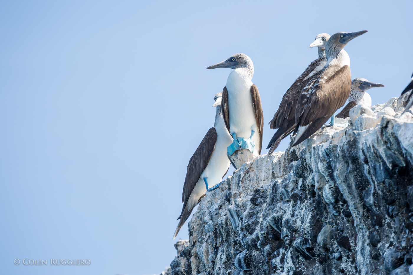
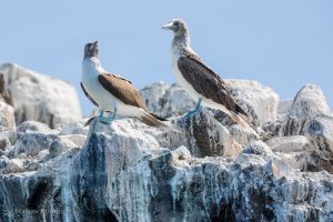
Blue-footed Boobies at Isla La Gaviota in the Sea of Cortez. Photo by Colin Ruggiero
At a time when over half the single people in the Americas have created an online dating profile through which they send out their virtual avatars to court potential partners, it may be difficult to remember the days of Saturday Night Fever and Strictly Ballroom when plumage and dance moves were everything. But off the coast of Baja California Sur on islands like La Gaviota, Isla Isabel, and Isla San Pedro Mártir, dancing to show off mating suitability is alive and well, although the practitioners looked so silly to early outside observers that they earned themselves the name of Booby, from the Spanish word bobo meaning “stupid” or “clown”. Pretty much your worst dancing-in-public nightmare.
But the Blue-footed Boobies of Baja remain unruffled, secure in the knowledge that shaking their tail feathers has resulted in what is possibly the largest Blue-footed Booby colony in the world. And it’s not just the moves that are important in their dance, but the exact cerulean hue the footwork displays. Blue-footedness, it turns out, is enhanced by the bright yellow pigments found in the carotenoids of the fish the birds consume, so those who catch and eat more fish get bluer feet. Ipso facto bluer feet connote better health, better health connotes greater ability to provide for a nest, and as every dancer in life thinking about raising a chick knows, those are the moves that really count in a mate. So the booby dance includes a series of steps in which the feet are raised up to allow potential partners to inspect their blue-ness (apparently a vibrant aquamarine is the most desirable) and determine if that’s the blue they want to get tangled up in. And unlike in some species in which only the male sports the color, in boobies both sexes are focused on the blue tones of a potential partner’s feet. In fact, males will avoid mating with females whose blue feet have been dulled with paint. With boobies, it definitely takes two to tango.
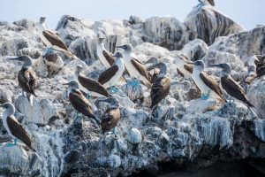
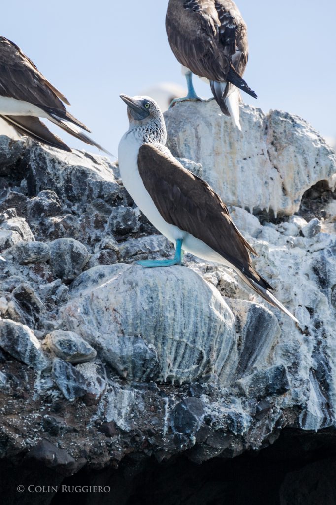
Blue-footed Boobies. Photo by Colin Ruggiero
And in many cases, three. Researchers have found that Blue-footed Booby rookeries could easily provide source material for the most salacious telenovelas; in over 50% of booby couples one or both partners engage in what scientists call extrapair behavior (what the rest of us would call an extramarital affair), and it is not at all uncommon for a booby to toddle off for a quickie with the neighbor while its mate is out foraging at sea. Dr. Hugh Drummond, Professor of Biology at the National Autonomous University of Mexico (UNAM), who has studied the Blue-footed Boobies at Isla Isabel for the last 37 years, notes his education on this point. “There was a time when we thought that all bird species were monogamous and mated for life. This couldn’t be further from the truth. The majority of studies indicate extra pair behavior in birds. This is not surprising in males as this behavior can provide them with extra offspring at no cost. What is surprising is that in the vast majority of bird species, including the Blue-footed Booby, the females stray. It’s surprising because this behavior can be accompanied by some fairly high costs.”
Scientists, being scientists, have been searching for a rationale for the female booby’s lustful leanings as “because she can” doesn’t square in a world in which behaviors are generally explained by survival and advancement of the gene pool. The working hypothesis was that a female who is nest hopping with the neighbors must be doing so because she is not paired with the ideal biological partner, and is therefore driven to hook up with a better set of genes. But, as Dr. Drummond notes, “Most studies have found no difference in the success of the mated pair’s offspring versus the success of the extra pair’s offspring. The extra pair males have not consistently proven to provide better genes than those of the mates. So we have to consider that the female’s behavior may not be for the benefit of the offspring after all.” Have female boobies liberated themselves from the Darwinian grind?
Blue-footed Booby in the Sea of Cortez. Photo by Colin Ruggiero
Possibly, but the males aren’t taking it lying down. They will destroy an egg in their nest if they suspect it was fertilized by another, and if the female was out of their observation range for a few hours or more during the 5 days of fertility prior to egg laying, then they are definitely suspicious. Dr. Drummond and his colleagues tested this by “kidnapping” males during the 5 critical days. Under these circumstances, the males destroyed the first egg subsequently laid, ensuring that they didn’t have to raise some other guy’s chick. If they are kidnapped prior to the fertile period they leave the egg alone. Male boobies will actually abandon particularly perfidious partners, and seek out others to soothe their ruffled feathers. Says Dr. Drummond, “Isla Isabel has roughly 2,000 pairs of Blue-footed Boobies, and at the end of every season half of the pairs break up.”
Before egg incubation starts, nearly all male boobies on Isla Isabel court extra pair females, while roughly one third of the females develop sexual relationships with one or more male neighbors. But booby mates who retain the same partner for successive years definitely reap gene pool rewards – Dr. Drummond has found that they produce 35% more offspring those who change partners. And while all booby couples share in parental duties, longtime mates spend equal time caring for their young. They are completely in it together, with males spending just as much time as their mates on household duties. Female boobies. Has their behavioral long game all along been shaping male boobies into the perfect domestic partner? That would be a remarkable evolutionary feat!
While longtime mates may cohabit harmoniously, harmony is definitely not a word one would associate with their offspring in the nest. Dr. Dave Anderson, Professor of Biology at Wake Forest University, has studied boobies in the Galapagos Islands for most of his adult life. He explains. “Nazca boobies (the Blue-foot’s cousin) only want one chick but they sometimes have two by mistake when their extra insurance egg hatches. In such cases, 100% of the time the older (or healthier) chick will force the other one out of the nest with no parental interference, and perhaps even some parental facilitation. Once out of the nest, a chick has no way to survive on its own. Nazca boobies nest on the ground in such a way that the nest is essentially a gladiatorial arena that the parents observe from on high.”
“The Blue-footed Boobies, on the other hand, do want the option of having two chicks. So they will give the first egg a head start of 3-5 days before laying the second egg, such that a natural dominance hierarchy is established among the resulting chicks. If food is abundant, they will raise both chicks. However, the first-hatched chick fiercely beats up the second-hatched, and the second-hatched survives only by adopting submissive behavior.” Dr. Anderson points out that the parents help the subordinate by building nests that are bowl-shaped, which means that when the older chick is pecking the younger one, at least for the first ten days or so, the poor little guy generally doesn’t fall out of the nest like its hapless Nazca counterpart – there are walls to keep it hemmed in. Further, unlike the murder-permissive Nazcas, murder-restrictive Blue-footed Booby parents will actually sit on their chicks to prevent the dominant from killing the subordinate.
Dr. Anderson tested what would happen when the constraints of the parents and the bowl-shaped nest are removed. “What is really interesting,” says Dr. Anderson, “is when we put Blue-footed Booby chicks in Nazca nests with Nazca parents. They are much more aggressive than when in their own nests. And when we put Nazca chicks in Blue-footed nests with Blue-footed parents, they still want to kill each other but can’t because of the shape of the nest and the murder-restrictive Blue-footed parents.” They may fool around like mad, but the Blue-footed Boobies do draw the line at siblicide, unless of course, food is scarce – as in an El Niño year – and subordinate chick sacrifices must be made.
Blue-footed Boobies. Photo by Colin Ruggiero
Now you may well imagine that the poor second-hatch chicks, having been so horribly abused by their siblings and practically starved to boot, would turn into physically stunted adults, emotionally crippled by their circumstances and consigned to a lifetime of failure. “Not so!” says Dr. Drummond. “We compared 1,167 fledglings of two-chick broods for 10 years and found few differences between first-hatched and second-hatched birds. Even more surprisingly, where there were differences these tended to favor subordinates.” By almost every measure that counts in a booby’s biological life, Dr. Drummond found that the subordinate chicks matched or bettered those of their dominant tormenters including survival, defensive ability, brood size, nest success, and cumulative brood size over the first ten years of life. Blue-footed Boobies. Liberated females, progressive males, bullies not allowed to flourish over others. What else can we learn from our blue-footed friends?
Every mating season the Blue-footed Booby males stake out their territories and wait for females to come by and notice them. “The males then fall all over themselves trying to demonstrate their suitability as a mate” says Dr. Drummond. One would think in such circumstances that younger, more virile (and of course bluer-footed) birds, would rule the day. But once again, things are not always as one would imagine in the booby world. Dr. Drummond and his colleagues have found that May-December romances among the boobies, i.e., partnerships in which one bird is old and one bird is young, produce offspring that are significantly more likely to later become parents themselves compared to the offspring of parents of a similar age. And it doesn’t seem to matter which sex is at which end of the age spectrum, old mothers and young fathers or old fathers and young mothers, the results were the same in the 3,361 booby offspring that Dr. Drummond and his colleagues studied – breeding in age-mismatched parents provides greater success in contributions to the gene pool than those of similarly aged parents. In fact, the advantage to the chicks born of May-December parents was almost as great as those conferred on chicks whose parents are in long-term partnerships. Why this is so remains a scientific mystery. Could it simply be that Blue-footed Boobies are as socially evolved as the French?
So now we know that these dancers who looked so silly they earned themselves the name of Booby may actually have some elegant lessons to share across species: 1. A rough start in life need not define your later years; 2. Sharing equally with a long-term partner produces better health for the family; 3. Age does not necessarily define your ability to contribute to society; and 4. Dancing your heart out no matter what you look like to strangers is one of the keys to a successful life. In fact, the future of the species depends on it.

 “Then 25 to 12 million years ago (Miocene period), the Farallon Plate in the Pacific Ocean started subducting east at a much steeper angle again, like a curtain whipping downwards” says Scott. “This steepening angle created more volcanoes, but their location shifted back to the west, tracking with the ever-steepening, subducting Farallon plate. The volcanic rocks from this period make up a lot of the flat top mesas that you see in Baja California today in areas like Cataviña and La Purisima, as well as the massive piles of volcanic rock in the high peaks of Sierra Madre Occidental in Sonora, Sinaloa and Nayarit. The Tres Virgenes Volcanoes, in the midsection of the Baja peninsula, were formed at the end of this period. Isla Espiritu Santo, off the coast of La Paz in the Gulf of California, gets its striking beauty from the wonderfully layered volcanic rock, mostly tuff (rocks made of compressed volcanic ash), that has been gently tilted along normal faults. Brian Hausback, a geology professor at California State University, Sacramento, has dated some of the volcanic rocks of Isla Espiritu Santo to 16-21 million years old, making them older
  than the formation of the Gulf of California seaway.”